
Blight in Manteca comes in many forms based on a proposed expansion of the redevelopment agency.
The 11 distinctive areas being considered for inclusion in Manteca redevelopment project No. 3 involve neighborhoods that include:
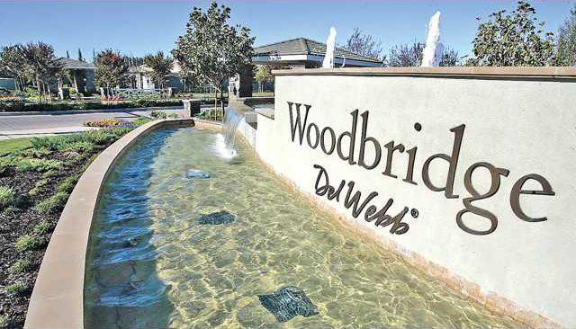
• a phase of Del Webb at Woodbridge that just broke ground along Lathrop Road west of Union Road.
• the McNary Circle neighborhood east and southeast of Doctors Hospital of Manteca.
• El Rancho Mobile Home Park and the almond orchards where the proposed 217-acre Yosemite Square Business Park project that includes plans for 314,000 square feet of office space, 414 condos, 335 homes, and 312 apartment units is located on the northeast corner of the Highway 120 Bypass and Highway 99 interchange.
• a strip along Atherton Drive east of Van Ryn Road where 300 apartments units have been approved.
• Manteca High - including pocket neighborhoods flanking the main campus - as well as Lincoln Park and Lincoln School.
• the Cherry Lane condos, Merrill Gardens and neighboring apartments and patio homes north of the Civic Center.
The Manteca Planning Commission when they meet tonight at 7 o’clock at the Civic Center, 1001 W. Center St., will consider adopting new study boundaries for the third redevelopment project area after it was determined certain properties originally included - mostly vacant and/.or agricultural land - did not meet state criteria.
City leaders are studying the possibility of including the 11 areas as part of a new redevelopment project area in a bid to retain more property tax for municipal needs. Property tax the RDA snags can’t go toward general fund functions such as police and fire services under state law. Inclusion in a RDA project area has no impact on the tax bill that a property owner pays but it does on how much various government agencies benefit from future increases in property taxes.
Manteca is at the forefront of a number of cities that are studying whether it make sense to add hard-hit neighborhoods to their respective RDAs as a way to stop the theft of local money by the state while at the same time generating revenue to help provide economic development within the impacted areas. State law allows the formation or expansion of redevelopment agencies to fight blight.
Roughly 11 percent of Manteca’s 23,000 housing units have fallen into foreclosure over the past four years.
Manteca, depending upon when various homes and other improvements were made, only gets between 6 and 11 percent of every property tax dollar that is collected in a non-RDA area.
Based on preliminary projections made in January on a larger project area, if all 11 neighborhoods are shifted to be included in the RDA boundaries the general fund will be shorted $50,000 by the fifth year and $100,000 annually by the 10th year.
By comparison the RDA after five years would capture $500,000 in property taxes annually from the 11 areas being considered for inclusion in the project area. By the 10th year the annual flow into the RDA coffers would reach $1 million.
It would end up keeping $900,000 more tax dollars in Manteca instead of going to Sacramento each year.
The $100,000 annual general fund loss is about four-fifths of the annual salary and benefits for an average Manteca police officer. Redevelopment agency funds can’t be used to hire police officers as they provide a citywide service.
The RDA as a whole is currently capturing $16 million a year in property tax increments compared to $4.5 million that the general fund receives. RDA money must be spent within in the project boundary. The only exception is the state mandated 20 percent set aside of every dollar in RDA taxes collected to go toward affordable housing. Affordable housing can go anywhere within the city.
Redevelopment agencies are allowed under state law established in the 1950s to fight blight and spur economic development. They work by capturing a set percentage of revenue from property tax increments the year they are formed. State laws require a chunk of the RDA property taxes to go to school districts with the state making sure school districts are kept whole.
The city has used the economic clout of the RDA for a wide repertoire of things from helping convert the shuttered Spreckels Sugar plant into a teeming 362-acre multi-use development dubbed as Spreckels Park to assisting in the development of subsidized housing for low-income seniors.
The general definitions of the areas being studied are as follows:
•The neighborhoods southeast of the Highway 120 Bypass and Airport Way interchange.
•The area where the 300-unit Tesoro apartments have been approved for construction on the northeast corner of Van Ryn Avenue and Atherton Drive.
•The sliver neighborhood on the east side of North Main Street between the Highway 99 off ramp and Lathrop Road.
•Land north of Lathrop Road from Calvary Community Church on the east to the western boundary of Del Webb.
•Neighborhoods bounded on the west by the railroad tracks, on the south by the newer developments along Alameda Street before dropping down to Alameda Street to include the Boys & Girls Club, on the north of Louise Avenue by about a block, to a point just west of Main Street, as well as Mayors Park.
•The neighborhood bounded on the west by the Tidewater Bikeway, on the north by Lathrop Road, the east by Main Street, and the south by Joseph Road.
•The Manteca High neighborhood.
•The McNary Circle area.
•A rural area along South Austin Road.
The 11 distinctive areas being considered for inclusion in Manteca redevelopment project No. 3 involve neighborhoods that include:
• a phase of Del Webb at Woodbridge that just broke ground along Lathrop Road west of Union Road.
• the McNary Circle neighborhood east and southeast of Doctors Hospital of Manteca.
• El Rancho Mobile Home Park and the almond orchards where the proposed 217-acre Yosemite Square Business Park project that includes plans for 314,000 square feet of office space, 414 condos, 335 homes, and 312 apartment units is located on the northeast corner of the Highway 120 Bypass and Highway 99 interchange.
• a strip along Atherton Drive east of Van Ryn Road where 300 apartments units have been approved.
• Manteca High - including pocket neighborhoods flanking the main campus - as well as Lincoln Park and Lincoln School.
• the Cherry Lane condos, Merrill Gardens and neighboring apartments and patio homes north of the Civic Center.
The Manteca Planning Commission when they meet tonight at 7 o’clock at the Civic Center, 1001 W. Center St., will consider adopting new study boundaries for the third redevelopment project area after it was determined certain properties originally included - mostly vacant and/.or agricultural land - did not meet state criteria.
City leaders are studying the possibility of including the 11 areas as part of a new redevelopment project area in a bid to retain more property tax for municipal needs. Property tax the RDA snags can’t go toward general fund functions such as police and fire services under state law. Inclusion in a RDA project area has no impact on the tax bill that a property owner pays but it does on how much various government agencies benefit from future increases in property taxes.
Manteca is at the forefront of a number of cities that are studying whether it make sense to add hard-hit neighborhoods to their respective RDAs as a way to stop the theft of local money by the state while at the same time generating revenue to help provide economic development within the impacted areas. State law allows the formation or expansion of redevelopment agencies to fight blight.
Roughly 11 percent of Manteca’s 23,000 housing units have fallen into foreclosure over the past four years.
Manteca sees more
tax dollars with RDA
Manteca typically gets only 10 cents of every dollar in property tax collected on property not included in an RDA project and 80 cents on the dollar from those that are within the boundaries of an RDA area. That 80 cents includes both RDA tax increment and general fund revenue.tax dollars with RDA
Manteca, depending upon when various homes and other improvements were made, only gets between 6 and 11 percent of every property tax dollar that is collected in a non-RDA area.
Based on preliminary projections made in January on a larger project area, if all 11 neighborhoods are shifted to be included in the RDA boundaries the general fund will be shorted $50,000 by the fifth year and $100,000 annually by the 10th year.
By comparison the RDA after five years would capture $500,000 in property taxes annually from the 11 areas being considered for inclusion in the project area. By the 10th year the annual flow into the RDA coffers would reach $1 million.
It would end up keeping $900,000 more tax dollars in Manteca instead of going to Sacramento each year.
The $100,000 annual general fund loss is about four-fifths of the annual salary and benefits for an average Manteca police officer. Redevelopment agency funds can’t be used to hire police officers as they provide a citywide service.
The RDA as a whole is currently capturing $16 million a year in property tax increments compared to $4.5 million that the general fund receives. RDA money must be spent within in the project boundary. The only exception is the state mandated 20 percent set aside of every dollar in RDA taxes collected to go toward affordable housing. Affordable housing can go anywhere within the city.
Redevelopment agencies are allowed under state law established in the 1950s to fight blight and spur economic development. They work by capturing a set percentage of revenue from property tax increments the year they are formed. State laws require a chunk of the RDA property taxes to go to school districts with the state making sure school districts are kept whole.
The city has used the economic clout of the RDA for a wide repertoire of things from helping convert the shuttered Spreckels Sugar plant into a teeming 362-acre multi-use development dubbed as Spreckels Park to assisting in the development of subsidized housing for low-income seniors.
The general definitions of the areas being studied are as follows:
•The neighborhoods southeast of the Highway 120 Bypass and Airport Way interchange.
•The area where the 300-unit Tesoro apartments have been approved for construction on the northeast corner of Van Ryn Avenue and Atherton Drive.
•The sliver neighborhood on the east side of North Main Street between the Highway 99 off ramp and Lathrop Road.
•Land north of Lathrop Road from Calvary Community Church on the east to the western boundary of Del Webb.
•Neighborhoods bounded on the west by the railroad tracks, on the south by the newer developments along Alameda Street before dropping down to Alameda Street to include the Boys & Girls Club, on the north of Louise Avenue by about a block, to a point just west of Main Street, as well as Mayors Park.
•The neighborhood bounded on the west by the Tidewater Bikeway, on the north by Lathrop Road, the east by Main Street, and the south by Joseph Road.
•The Manteca High neighborhood.
•The McNary Circle area.
•A rural area along South Austin Road.


