Get ready for a Pineapple Express.
The National Weather Service is expecting a wet but warm storm system to hit the Central Sierra later this week dropping as much as 3 to 6 inches of rain on a snowpack that is still half of where it should be after a wetter than normal March. Little in additional snow accumulation is expected from the upcoming storm.
The Department of Water Resources’ most crucial snow measurement of the year taken on Monday — April 1 marks the official end of California’s rainy season for water delivery planning purposes — showed the state’s snowpack at 52 percent of normal.
“A good March, but certainly not a great March,” noted state snow-survey chief Frank Gehrke on Monday after measuring 32.1 inches at Phillips Station in El Dorado County at an elevation of 6,873 feet.
That means much of California will be relying on water saved in reservoirs from the near-record 2016-2017 winter that ended the state’s 25 percent conservation order for cities that was in place for four years.
The 52 percent of average snowpack — while significantly better than on March 1 — indicates the state may be slipping back into drought conditions. The United States Department of Agriculture Drought Monitor shows 42 percent of California is currently in drought conditions. That’s down from 48 percent in mid-March before a series of storms hit the state.
The South San Joaquin Irrigation District that supplies water to Manteca, Lathrop and Tracy as well as irrigation water to farms around Manteca, Ripon, and Escalon expects to be able to make full deliveries based on snowpack on the Stanislaus River watershed.
That said, SSJID General Manager Peter Rietkerk has repeatedly advised urban and farm customers to use water wisely as there is no assurance that next the 2018-2019 water year will receive adequate snowpack meaning a carryover supply of water is a prudent move to protect against earnest drought conditions returning in the coming 18 months. Manteca had gone five years in drought conditions before last year’s above normal winter snowfall.
“Potentially, we’re living off our savings from last year so we have to be very prudent in our water use,” Gehrke said.
The snow station near Sonora Pass at 8,870 feet on the upper reaches of the Stanislaus River watershed had 60 inches of snow on Monday with a water content of 19.7 inches. That is a big improvement over March 1 when the snow was at a quarter of normal with 26 inches of snow and 7.7 inches of water content.
The Central Sierra — the watershed critical to Northern San Joaquin Valley farms and cities — is rated as abnormally dry by the USDA Drought Monitor while San Joaquin County is considered to be in normal status due to rainfall while neighboring Stanislaus County to the south is rated as abnormally dry.
Since the governor’s emergency drought declaration was lifted, Californians are using almost as much water as before the previous drought. That has prompted the state to ramp up its messages to be thrifty with water.
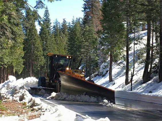
The incoming storms system did not deter Caltrans from starting to plow Highway 108 heading up to Sonora Pass on Monday. Caltrans crews assigned to the Long Barn maintenance yard started plowing the road above Strawberry beyond the Sno-Park area at roughly 5,500 feet
Northern California is expected to get widespread precipitation between Thursday and Sunday with the heaviest rain on either Friday or Saturday.
Snow is expected to accumulate mainly above 8,000 feet until late Saturday or Sunday while snow may fall as low as 5,000 feet.
Between three to six inches of rain is expected in the Sierra with one to two inches in the San Joaquin Valley.
To contact Dennis Wyatt, email dwyatt@mantecabulletin.com
CUP ONLY HALF FULL
Critical snowpack at 52% of normal