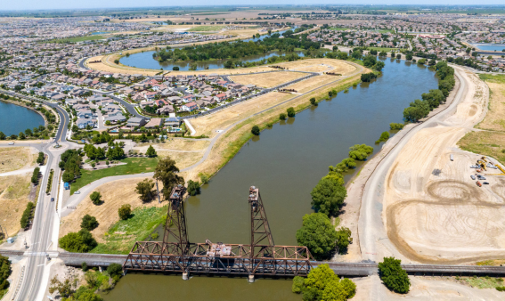
Work on raising and extending the dry levee just to the south of the City of Manteca is now targeted for completion by mid-2029.
It is part of an effort to upgrade flood protection for 22,600 acres on the eastern side of the San Joaquin River between a point south of the Weatherbee Lake just west of Manteca to Weston Ranch in South Stockton.
The Manteca City Council is being updated on the project progress tonight during their 6 p.m. meeting.
The presentation comes 29 years and 3 days after levee failures between Airport Way and a point south of Reclamation District 17 that protects most of the area in the current proposed $473 million project flooded more than 70 square miles between Manteca and Tracy.
Crews battled boils — the precursor to potential levee failure – around the clock for three days to prevent the river from breaking through levees flanking the Interstate 5 crossing and sending floodwaters into Lathrop east of the river and into Weston Ranch.
The dry levee south of Manteca had plastic sheeting placed atop it as floodwater lapped at the top threatening to breach it.
There was no tract home development in the area back then when state emergency coordinators plugged the McKinley Avenue underpass of the 120 Bypass with dirt to create an emergency back-up levee if needed to prevent floodwaters from reaching the neighborhoods southwest of Sierra High.
The Interstate 5 undercrossing of Louise Avenue in Lathrop was also plugged with materials and equipment staged at the Lathrop Road and Roth Road undercrossings to do the same thing,
There was no tract home development in Lathrop west of Interstate 5 back then.
Dryland levee route will
restrict Manteca growth
The existing dry levee and the proposed three-mile extension to the east to Tinnin Road will effectively stop the future southern expansion of the City of Manteca in the area to the south of the more robust and longer levee.
That is because after 2030 — if measurable progress isn’t being made to protect areas identified by the state as being in a 200-year floodplain — no new construction will be allowed or the footprint of structures enlarged under California law.
The city could grow farther south to the east of Tinnin Road as it is outside the 200-year floodplain.
A 200-year flood is terminology that may mislead those not familiar with hydrology lingo.
It refers to the odds of various scales of flood events happening in any given year.
As such, a 200-year flood doesn’t happen every 200 years give or take. Instead, it has a 1 in 200 chance of happening in any given year.
The 1997 flood challenged protection that was in place — and still is — for a 100 year-flood event.
The levees protecting River Islands of Lathrop, a planned community of 15,001 homes west of the San Joaquin River, have been certified as meeting 200-year flood protection criteria.
Stewart Tract, where the planned community is being built, had flooded numerous times in the past century.
The existing dry levee will be raised by up to another two feet and widened by an additional 10 to 20 feet.
Work is expected to start in the third quarter of 2027.
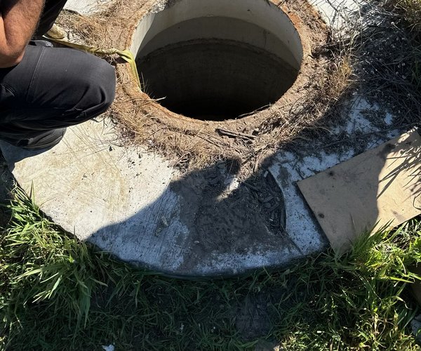
It will require work on Woodward Avenue where is crosses the dry levee just south of the southern entrance to the Oakwood Shores gated community.
Various project tidbits
*The project will allow recreational use — walking, bicycling, and such — on the levee top between Dos Reis Regional Park just north of Lathrop to the boat launch and small park at the Mossdale Crossing.
*The first flood walls in the area — concrete structures to hold back water — will be built on either side of Interstate 5’s San Joaquin River crossing due to limited area where the levee can be raised and widened.
*The most intense work involving raising the levee in additional to seepage berms and other improvements on the land is between the dry levee and a point in Lathrop of Louise Avenue continued westward instead of curving south after passing River Islands Parkway.
*The project will require removing 918,000 cubic yards of earthen material and then importing 1.3 million cubic yards.
*The overall project once it starts will see anywhere from 57 to 294 truck trips each day.
The project is being pursued by the San Joaquin Flood Control Agency consisting of Manteca, Lathrop, Stockton, and San Joaquin County.
Generally, the portion of Manteca in the 200-year flood plain is everything west of Airport Way and a section of area east of Airport Way that extends in various degrees toward Union Road based on elevation.
To contact Dennis Wyatt, email dwyatt@mantecabulletin.com