
Lathrop High opened in August 2008.
It was built next to the San Joaquin River east of Interstate 5.
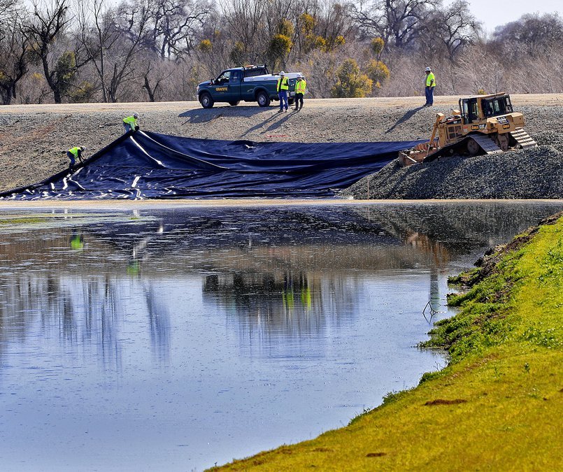
The area was ready to be sacrificed in January of 1997 when a series of boils signaled the high possibility the levees along the river were in danger of failing.
Crews worked the boils while Caltrans workers plugged the Louise Avenue underpass of Interstate 5 with dirt and had piles of dirt and a skip loader along with plastic sheeting on standby to do the same at the Lathrop Road underpass
Interstate 5 — when it was built — had been elevated out of the floodplain after the disastrous 1950-1951 flood inundated the area where Lathrop High is located.
It was why the state required the high school campus to be elevated out of the 100-year floodplain by bringing more dirt to the site.
While the levees didn’t fail that protected Lathrop, they did south of Manteca and east of Tracy resulting in 70 square miles being flooded, 2,000 people evacuated, and more than 500 homes damaged.
That said, the state in 2008 — responding to an assessment of levees nationwide by the Federal Emergency Management Agency after the Hurricane Katrina disaster in New Orleans in 2005 that determined the levees around the Sacramento-San Joaquin Delta have the highest risk of failing nationwide — upped the minimum flood protection mandate to withstand 200-year floods.
Not only is Lathrop High and much of the rest of the community, parts of Stockton, and areas in Manteca not protected from 200-year floods, but models show weather patterns are likely to result in a tripling of annual water flows in the San Joaquin River by 2070.
That’s because the climate is shifting to more rain at the lower elevations and less snow in the Sierra.
It is against that backdrop the Manteca Unified School District board when they meet tonight will consider authorizing Superintendent Clark Burke to cast ballots in favor of a 30-year assessment to pay for the district’s share of $467 million in upgrades needed to protect against 200 year flooding.
Manteca Unified has 39 parcels in Lathrop, the Weston Ranch area of Stockton, French Camp, and parts of eastern Manteca that are within the 200-year floodplain.
The annual assessment for the district is $49,770. Without the maximum 4 percent annual inflation for assessments built into the authorization vote the district will spend $1.49 million in fees over the next 30 years.
In comparison, to replace Lathrop High would cost in excess of $160 million.
If approved, work will start on the flood protection upgrades in 2026.
In flood lingo, a 200-year event doesn’t mean a flood that will happen every 200 years.
Instead, it reflects the odds of such an event happening in any given year. That means there is a 1 in 200 chance of an event occurring in any given year requiring the levee work now being pursued.
Roughly 40 areas in California including Manteca-Lathrop-Stockton fall within peer reviewed science that designated 200-year flood plains. They must have — or be in the physical process of constructing — protection to guard against such an event by 2030.
To contact Dennis Wyatt, email dwyatt@mantecabulletin.com


