
About a dozen or so residents from the area impacted by the Manteca Dry Land Levee Project believe their lifestyles, their neighborhood, and their property values are being sacrificed for the benefit of more development.
If 200-year flood protection is not in place or in the process of being built by 2030, the state will halt all new development in the impacted area.
Residents turned out Monday for a Planning, Evaluation & Concept Project presentation at the Manteca Transit Center.
They were concerned about the plans for dry land levees that could affect the longtime homes in south Manteca.
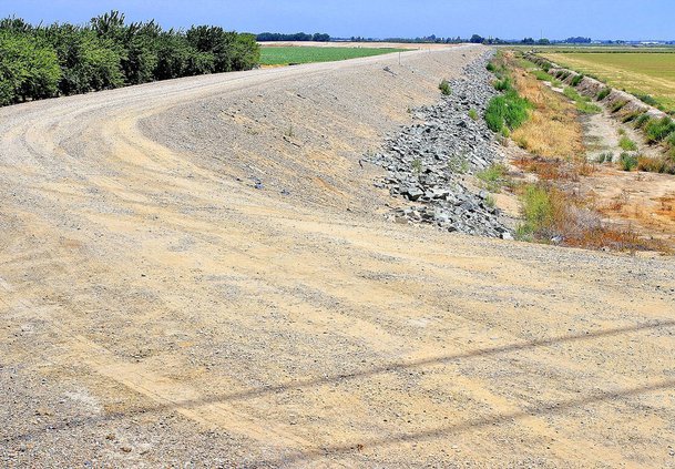
Engineers, as part of the state-mandated 200-year flood protection for a large portion of southwest Manteca and into parts of Lathrop — further south than originally envisioned — worked with the San Joaquin Area Flood Control Agency on alternatives for the cross levee designed to hold back flood waters from the San Joaquin and Stanislaus rivers.
One resident said the alternatives considered "does not seem like a regional fix but a targeted fix."
By that, she indicated the dry levee would "cut the region in half."
Chuck Hilliard, who is the Associate Engineer / Water Resources with Wood Rodgers engineering firm, noted that the public outreach session was part of the project approach for updating the Drake Haglan Alternatives from 2016. Included were principles / criteria to minimize farmland impact, minimize impacts to property owner access, and "wise use of floodplains," to name a few.
"We're looking to build on that and how it impacts the property owners," Hilliard said.
Hydrologic and hydraulic modeling on the 200-year floodplains has already been completed in the region by MBK Engineering. Hilliard said that it was in coordination and cooperation with engineering teams of prior efforts.
A geotechnical analysis was also conducted on seepage mitigation.
Kim Floyd of SJAFCA Public Outreach pointed out that the alignment alternatives were "footprints" of the 2016 Drake Haglan as a starting point but modified to account for seepage mitigation measures along with minimizing property impacts and extending the protection to the future 200-year floodplain boundary.
The terms “100-year” or ”200-year” refers to the odds of a likelihood of major floods occurring in a given year rather than the frequency. Since 1929, the river levees have failed 11 times including the one in 1997 in which flood waters lapped to the top of the existing dry levee, south of Woodward Avenue to as far west to Airport Way.
Hilliard said the steps ahead include coming up with a preferred alternative to go with the California Environmental Quality Act — or CEQA, which generally requires state and local government agencies to inform decision makers and the public about potential environmental impacts of proposed projects.
This is an opportunity for residents to voice their concerns, according to Hilliard.
The next session is planned for October with a possible drafting of an Alternative Analysis Report.
The final Alternative Analysis Report is targeted for December.


