San Francisco, by any stretch of the imagination, is not a hotbed of “climate change deniers.” It’s been that way for more than a decade and counting. Yet the powers that be in San Francisco in recent years embraced a plan to take the population of Treasure Island from a population of 2,000 to 19,000, build up to 500 hotel rooms, and add tons of commercial buildings to create a $5 billion neighborhood.
Just one small detail.
Gee, did SF have anything to do with putting more people at risk from rising sea levels?
PERSPECTIVE


Latest
-
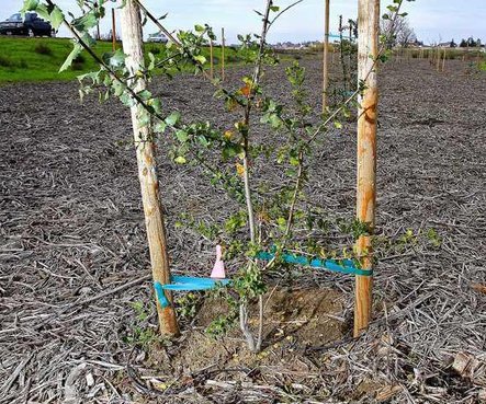 Manteca Scenic Byway: Home of the ‘green waste’ trees & shrubs costing $13,600 a pop
 -
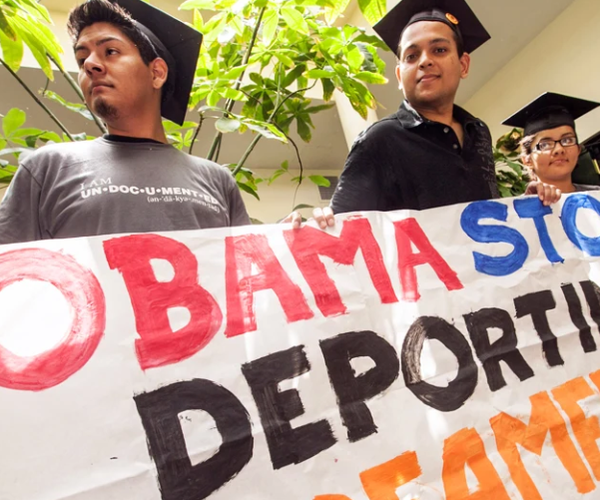 After spending $100 billion to educate DREAMers, USA, is now deporting them
 -
 Nothing is more bizarre than Californians mocking Californians for being Californians
 -
 Stuff the Bus: A Christmas ‘toy’ wish of a 7th grade boy is something I’ll never forget