The future of agriculture can be found a few miles south of Manteca.
It is in the vicinity of a small community of houses that carries the Latin name for spring: Vernalis.
Vernalis is also the name given to area where the Stanislaus and San Joaquin rivers converge just before the Delta begins. Because of that, Vernalis serves as the epicenter of all things political in California water wars. Flooding here is a certainty. Eleven times since 1929 the levees along the rivers have failed flooding upwards of 45 square miles south of Manteca like clockwork.
It is here where vast fields of farm crops dotted by occasional orchards and dairies reign supreme.
Cross the San Joaquin River on Airport Way and jog to the left and you’re at a historical marker on Kasson Road that is all that is left of San Joaquin City. It was once a bustling river port in the late 19th century serving what was then dubbed the Wheat Basket of the World. It is where river barges transferred cargo from wagons to deliver harvests to the world.
San Joaquin City disappeared for the same reason other settlements that once were booming failed to take hold. It was in the wrong place. Railroads passed them by as did key state highways. Once simply being located on a major waterway assured a town of survival. That wasn’t the case in the late 19th century when the rules of civilization changed. Mechanized transport using railroads and eventually the automobile changed the patterns of community building.
Kasson Road eventually takes you to Highway 132 where a short drive to the west will hook you up with quiet Highway 33.
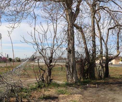
The narrow asphalt ribbon cuts through the gut of the Northern San Joaquin Valley and to small towns like Westley, Gustine and Newman. Urbanization isn’t a big issue here. Farm prices are.
Highway 33 connects the West Side farm communities. Orchards, row crops, alfalfa blur together in an endless mosaic.
The West Side, as it is known, is the western edge of the Northern San Joaquin Valley. It is just one piece of the Central Valley that reigns as the world’s most productive farming region. It is here you’ll find an impressive manmade feature. The California Aqueduct sends a river of water daily toward Southern California and the massive corporate farms of the Southern San Joaquin Valley’s western edge.
This is where California must make a stand.
Pressures will come one day. It isn’t too far-fetched to see Gustine become a favored commute to the University of California at Merced or for the other towns to start swelling as industrial/distribution jobs start coming to Ripon, Tracy, Lathrop, Manteca, Stockton and Modesto in greater numbers.
This is where the state needs to apply radical policies such as severe development restrictions in exchange for freeing farmland from all taxes. It is far cheaper and more effective to reimburse counties for lost general county property taxes than any scheme exchanging taxes for a lock on land use for farming or bankrolling ag conservatory areas with state funds. The system in place today barely protects a single pea on the huge buffet table of California agriculture.
It is time for California leaders to take a radical stand before urbanization pressures eventually change the sleepy asphalt ribbon known as Highway 33 into yet another commuter corridor.
Vernalis: The epicenter of farming & water wars


Latest
-
 Zipping over Altamont at 125 mph: But first get ready to hop aboard ACE in downtown Manteca
 -
 Manteca Scenic Byway: Home of the ‘green waste’ trees & shrubs costing $13,600 a pop
 -
 After spending $100 billion to educate DREAMers, USA, is now deporting them
 -
 Nothing is more bizarre than Californians mocking Californians for being Californians