Manteca’s build-as-you-grow approach to major roads makes sure that development pays the tab.
The approach, though, has major unintended consequences given the way Manteca has been doing it for the past 30 plus years as it delays — or simply avoids — specific corridor planning. The end result at times looks like a mumble jumble approach as major streets unfold. It also has a tendency to be hit and miss when it comes to meeting policy goals outlined in the current Manteca general plan — the city’s blueprint for growth — when it comes to being able to accommodate roundabouts or even remembering to include bus turnouts at significant retail developments along major roads.
While the city has identified lines for where key streets are planned on maps of the city as part of the traffic circulation elements of general plans, they have never provided corridor planning per se.
The end result is emerging community battles involving how key corridors develop such as:
uWoodward Avenue and Lathrop Road.
ucontinuing to flip flop on the 100 block of North Main Street in downtown Manteca.
uless-than-stellar relationship with rural residents over the uncertainty of the Raymus Expressway and whether it may even by a smart move if the state pursues an $80 million fix for the Highway 99 interchanges with the 120 Bypass and Austin Road that could make a Raymus interchange need moot or a hideously expensive redundancy.
ua seeming lack of understanding of what the future intent for Atherton Drive is as the city grows to the south.
City has had to
correct mistakes
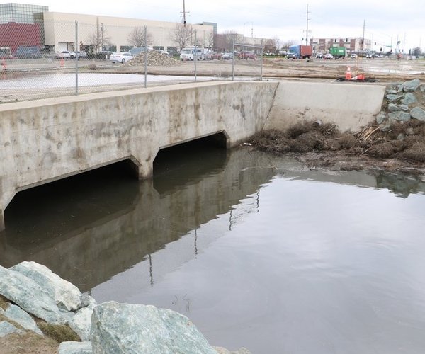
The lack of corridor plans and a clear vision of what development will bring in means of traffic have forced the city to go back and make improvements on its dime to make sure streets such as Spreckels Avenue — clearly built to serve distribution centers — could accommodate smooth right turns by semi-trucks at intersections.
Arguably the most egregious — and longest existing — “mistake” on a major traffic corridor in Manteca can be found just east of Main Street and Louise Avenue. It happens to be the city’s busiest intersection with more than 36,000 vehicles passing through on an average day the last time there was a traffic count done. It is where two lanes in each direction go down to one and then back to two lanes.
It’s been that way since the early 1980s when the council at the time was reluctant to use eminent domain and figured developers would eventually buy the half dozen or so homes and build new homes where part of their front yards are needed to widen Louise. They were equally reluctant to go ahead and widen Louise and bring the road with a dozen or so feet of the homes.
A short time later the Cardoza Center that is now anchored by 24 Hour Fitness and the SaveMart shopping center were built on either side of Louise Avenue east of Main Street. When they were completed key entrances to each center did not align creating an off-set driveway that has been problematic ever since.
That led to the city hiring its first — and last — public works staff member responsible exclusively to making sure similar situations did not occur while working with neighborhoods to devise ways to slow down traffic and enhance safety. The position went vacant before the Great Recession hit and has not been filled since.
Current council is
attempting to avoid
past traffic problems
The current City Council is trying to address some of the shortfalls in corridor planning. They have realized the policy of previous councils to assume words and maps in a general plan regarding major traffic corridors was all that was needed for overall road planning and not more specific corridor design is inattequit. Instead they left corridors to develop as the city grew believing there was no need to spend money on specific planning for what a corridor would ultimately look like from one end to another. Corridor design has been on a piecemeal basis until projects move forward.
It has effectively put Manteca in a position to make more expensive and argumentatively less effective improvements as sections of the city develop.
One example is the intersection at Pillsbury Road and Woodward Avenue. Preliminary studies a few years back indicated it had ideal future traffic conditions for a roundabout in terms of eventual traffic flows instead of traffic signals when it comes to keeping traffic moving, slowing down vehicles on Woodward, and making it safer for pedestrians to cross what is essentially a five-lane corridor that many nearby residents equate to the Indianapolis Speedway.
But after looking at it, the city’s failure years earlier to think of the optimum corridor design for Woodward Avenue from Oakwood Shores to Moffat Boulevard, led it to allow development that limited its options for intersections. The city now plans to go initially with a three-way stop with flashing red lights at Pillsbury and Woodward and then install traffic signals eventually. It will cost more initially than a roundabout and will have higher ongoing maintenance cost.
The four initiatives the council has directed staff to take to make traffic planning more effective instead of having it steered when actual growth takes place includes:
uidentifying all other possible Louise Avenue situations where major streets would go from two down to one and back to two lanes where development is occurring adjacent to parcels not likely to develop in a reasonable time frame such as on Union Road and Main Street south of Woodward Avenue, to have the cost of widening those sections included in the major road fees assessed on growth.
u$150,000 for a Lathrop Road corridor study of existing land use needs and patterns with needed transportation improvements along the Lathrop Road corridor from the eastern Union Pacific grade separation to Cottage Avenue.
u$125,000 for a citywide traffic route study of existing land uses in the city and the expected truck generation from such and how to efficiently allow truck travel while minimizing cost to the triple bottom line (economic, environment and social).
ulooking at the 100 block of North Main Street before moving forward with the $1 million landscape bulb-out removal and lane reconfiguration to make sure what is put in place will not have to be removed to accommodate the maximum traffic flow that is possible within the existing physical constraints of the Main Street corridor.
Lathrop Road corridor
has a lot of issues
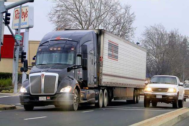
Lathrop Road has a number of issues residents have been expressing concerns about ranging from sight-lines, speed, safety, truck traffic, and access points.
Making some suspicious as to whether the city has a handle on Lathrop Road have been decisions by the Lathrop City Council on their section of Lathrop Road as well as Manteca municipal staff recommendations — or lack thereof — involving a proposed three-story apartment complex.
Lathrop has applied to the state for the designation of their section of Lathrop Road as a Surface Transportation Assistance Act route. That means larger trucks — primarily interstate trucks — than what California legally allows on non-freeway routes would be allowed. Such a designation also requires wider right hand turns on such truck route corridors.
The city in development agreements requires CenterPoint truck traffic, as that project develops along Airport Way north of Lathrop Road, to not use Lathrop Road but instead Roth Road to reach a freeway.
Del Webb residents are leery of the promise and whether the City of Manteca will even actually enforce it given their lack of traffic enforcement officers as well as city history of not holding the developer to landscaping and façade requirements outlined in the development agreement.
There is also the impression that Caltrans improved the new Lathrop Road/Highway 99 interchange with the idea of making Lathrop Road a truck route. It was actually an operational decision given the 1955 design of the interchange, widening the freeway to six lanes, and planned Manteca development that the interchange will serve.
Del Webb residents a few years ago successfully pointed out to the city that median landscaping along Lathrop Road at Madison Grove — one of three access streets to the planned community of 1,460 homes — was blocking sight lines and creating a safety hazard.
And while Del Webb residents argued against an apartment complex proposed between their neighborhood and Lathrop Road as it didn’t fit into the overall city adopted Union Ranch Specific Plan that Del Webb is a apart of, the project failed to comply with two general plan traffic safety objectives.
One was the lack of a bus turnout for either Manteca Unified or Manteca Transit buses. The other is no access to the city’s separated loop bicycle path system that runs directly behind the proposed apartment complex. Both are key elements of safety and alternative transportation options.
From that aspect, Atherton Drive that already has a high concentration of apartments and the city’s largest retail complex in terms of square footage — Orchard Valley — also does not have bus turnouts — despite the policy calling for them in the general plan.
Woodward Avenue
has a split personality
A previous City Council decided to back off on the concept of having Woodward Avenue four lanes from Atherton Drive in the east to Oakwood Shores in the west.
That’s because when plans for Atherton Drive first surfaced in the late 1990s, it made a previous traffic circulation plan calling for Woodward Avenue a quarter of a mile to the south redundant or, as some would contend, an expensive overkill, to build and maintain.
The council back then directed staff to make Woodward Avenue from Main Street to the west more of a collector street with a lane in each direction, a wide median lined with trees, and homes facing Woodward Avenue with deep setbacks instead of lining the corridor with sound walls.
From a traffic standpoint, they didn’t want a repeat of Woodward Avenue from Bridewell Avenue to Main Street where two wide lanes in each direction with a landscaped median had created a speedway of sorts leading to solo accidents that take out trees and street light poles on a regular basis. Having five lanes to cross as its cuts through a residential neighborhood makes it precarious for kids walking to and from school or anyone trying to access Woodward Park from the north side of Woodward Avenue.
The city also didn’t want to impact the 72 homes that already existed along Woodward Avenue between Main Street and Airport Way. The change means that the corridor will not go from sound walls to front yards and back multiple times.
At buildout the road design is expected to slow down traffic.
Should the city and Caltrans agree on a new Austin Road interchange as part of the solution for the safety and traffic volume issues at the 120 Bypass and Highway 99 interchange, it would again change the dynamics of Woodward Avenue. If the full interchange option for Austin Road moves forward, Woodward Avenue would no longer connect to Moffat Boulevard. When Atherton Drive heads south and connects with a new Austin Road alignment, the need for Woodward Avenue as a four-lane road would be significantly reduced.
A previous council had suggested redesigning Woodward east of Main Street and taking it down to one lane in each direction with a wide bicycle lane. In front of Woodward Park diagonal parking was suggested with possible shifting the lanes to the north to allow a parking lane behind the diagonal spaces. Besides slowing down traffic on Woodward, such a strategy would take pressure off residential street parking during soccer matches and events at Woodward Park.
The idea was given a quick look over but wasn’t pursued further.
To contact Dennis Wyatt, email dwyatt@mantecabuleltin.com