A $12.1 million dry levee option tagged for intense vetting in southwest Manteca will increase flooding for those who live and farm south of the alignment known as Alternative 2A.
Ed Fonseca doesn’t need a $1 million plus, three-year long environmental review process to verify that will happen. All he needs to do is look at past history — including floods as far back as 1951 that he lived through — plus apply what he called “common sense.”
Protecting a portion of Manteca as well as all of Lathrop, French Camp, and the Weston Ranch area of Stockton against a flood event that has a 1 in 200 chance of happening in any given year means an extended and higher alignment of the existing dry levee south of Woodward Avenue. That will back up more water on the south side to protect those to the north. That includes, as Fonseca pointed out, several thousand Manteca homes that haven’t even been built yet, at the expense of rural homes and farms.
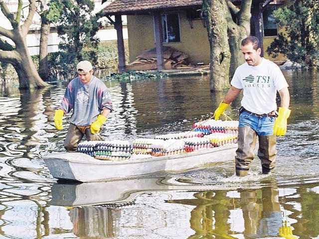
Kerry Harris notes her family home — that was inundated with 20 inches of water during the 1997 flood — would receive an additional three feet of water based on general engineering assumptions if the proposed dry levee project goes forward. That’s because the 1997 event was only half the magnitude — a 1 in 100 chance of happening un a given year — than what the state is mandating be put in place if building is to continue in the 200-year floodplain.
The Manteca City Council voted 4-0 Tuesday — with Councilman Vince Hernandez absent — to proceed with further study of Alternate 2A, possible variations of that alternative, and a no-build alternative. The environmental review process would start in 2017. The environmental work would be done and final engineering begun in 2020. That is the same year right-of-way acquisition would start. The target to secure the land and begin the permitting process is in 2022. Construction under the timetable would start in 2024.
Fonseca along with Mike Davis who also lives south of the proposed dry levee alignment raised a possibility that has been given scant consideration — at the end of the exhaustive EIR process the state may not approve levee plans.
Fonseca noted that if that happens, the city by continuing to issue building permits would be exposing possibly thousands of future homes and their owners to flooding.
Impacted property owners
want city to freeze building
in 200-year floodplain
Davis asked for the council to consider imposing a freeze on any building permits in the 200-year floodplain in Manteca. Besides more than a half dozen approved subdivisions along Woodward Avenue east and west of airport Way it also includes the city’s signature family entertainment zone [project and the envisioned 500-roopm waterpark resort and conference center.
Fonseca suggested the environed levee isn’t being extended far enough. He argues it would have to go all the way to Union Road, a half mile beyond its projected terminus at Oleander Avenue. Whether that is needed is what the more exhaustive examination of the alternative and hydrology will determine.
Back in the 1997 floods state Office of Emergency Services personnel were motioning the dry levee that had been coated in plastic sheets on a 24-hour basis for several days looking for possible failures. The underpass on McKinley Avenue was plugged with dirt to turn the 120 Bypass into a back-up levee to protect homes to the north. At that time there were no city tract homes built in and around Airport Way and Woodward Avenue.
Councilman Mike Morowit acknowledged there was no perfect solution. He added that a full blown EIR study will answer critical questions he has if he is around when a final decision on the alignment is made tentatively in 2020. There are two city council elections between now and then that could put five new council members in place to make that final decision.
Noting that there are 75,000 existing Manteca residents to take into consideration when it comes to flood protection, Councilman Richard Silverman said voting to further study Alternate 2A as the possible answer was justified.
Critics contend the levee project that includes shoring up existing levees along the San Joaquin River could carry a price tag in excess of $200 million is being done only to accommodate future growth. They noted language in Senate Bill 5 — the law that mandated 200-year flood protection — makes it clear it has to be in place only if jurisdictions want to allow new construction to continue.
“This whole thing is not development driven,” Mayor Steve DeBrum said. “The State of California is setting the guidelines.”
DeBrum noted without the dry levee protection everything from the San Joaquin County Hospital to thousands of existing homes in three communities involving more than 20,000 people would be in harm’s way in a flood that has a 1 in 200 chance of occurring in any given year.
Where Alternate 2A would
go and what it would protect
Consultants contend Alternate 2A minimizes farmland impact, stays on property lines as much as possible, accommodates entitled subdivision projects within Manteca’s city limits, makes the best use of existing easements, and has the greatest consensus among stockholders of all of the alternatives.
The alternate uses the existing dry levee alignment south of Woodward Avenue until it reaches a point that is midway between the existing McKinley Avenue alignment and Airport Way. It then swings south until it reaches a point to the west of Fig Avenue. It turns east along a path that would be slightly north of Fig Avenue if it was extended due west from Airport Way. Before reaching Airport Way, it jogs further north a bit so that it aligns as much a possible with existing property lines before ending at Oleander Avenue.
Should a 200-year flood occur with multiple levee failures along the Stanislaus and San Joaquin rivers south of the Interstate 5 bridge before the merger with the 120 Bypass, it would:
uflood 4,200 existing homes with 3 feet or more of water.
uendanger and force the evacuation of 10,698 residents in Lathrop outside of River islands, Weston Ranch in Stockton, and southwest Manteca.
uforce the evacuation of San Joaquin Hospital — the county’s major trauma center — as well as the county jail.
uforce first responders at nine fire stations, the Lathrop Police Department and the county sheriff to abandon their stations and key communication centers in the middle of a major emergency.
uLathrop High and Weston Ranch High would have water flowing through their campuses as would six other Manteca unified elementary schools.
uforce the closure of portion of Interstate 5 — the major West Coast freeway running from Mexico to Canada — and the 120 Bypass.
uwater would swamp the wastewater treatment plant serving 75,000 existing Manteca residents and more than 13,000 of Lathrop’s nearly 20,000 residents.
udisrupt Union Pacific Railroad train movements as well as damage tracks that Altamont Corridor Express relies on.
u182 commercial and industrial properties from Costco to the Lathrop Target and Tesla Motors to Simplot would be flooded.
And that’s just for starters. Modeling shows a number of existing homes would likely suffer water damage in fringe areas that could receive upwards of three feet of flood water.
Manteca, Lathrop, and Stockton aren’t the only communities impacted by the Senate Bill 5 mandate. There are 85 cities in 33 Central Valley counties that have to comply.
To contact Dennis Wyatt, email dwyatt@mantecabulletin.com
FLOODING WILL BE WORSE
Those south of dry levee would get more water