
Future development in the impacted 200-year-flood plain within Lathrop, Manteca, the Weston Ranch area of Stockton, as well as portions of rural San Joaquin County will help retire bonds to strengthen and extend levees.
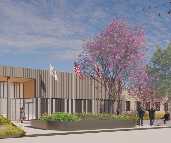
The Manteca City Council Tuesday joined Lathrop in indicating they plan to participate in the Mossdale Tract Enhanced Infrastructure Financing District to help pay off bonds needed to meet a state mandate to put in 200-year flood protection in place.
Bonds the financing authority will issue will pay for improvements expected to cost in excess of $180 million to provide southwest Manteca, part of the Airport Way corridor north of the 120 Bypass, Lathrop north and east of the San Joaquin River, Weston Ranch, French Camp, and the rural area between Lathrop and Stockton with protection against flooding events that have a 1-in-200 chance of occurring in any given year.
Without the enhancements in place by 2030 that exceed the current levees designed to withstand floods that have a 1-in-100 chance of happening in any given year not only would new development in the impacted areas cease under state mandate but so would any additions to existing property.
It also would subject existing homeowners in some cases to expensive flood insurance if their mortgages are backed by the federal government. Such coverage elsewhere in flood-prone areas of the San Joaquin Valley typically costs between $2,000 and $3,000 a year.
What will happen once the Mossdale district financing authority is in place, jurisdictions with property in the impacted area will contribute a percentage of the property tax increments generated to help retire the bonds.
The taxes will be taken from new development, the 2 percent annual cap on property tax increases, as well as reassessments triggered by the sale of property.
The Mossdale district includes 5,125 developable acres projected to yield 11,200 more homes and an additional 33.1 million square feet of non-residential buildings at buildout by 2060. That would mean everything west of Airport Way to the San Joaquin River north of a proposed dry levee extension south of Manteca to French Camp Slough in the north would be completely urbanized.
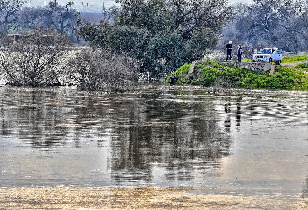
That area — as well as a large swath of central Stockton — was covered in floodwaters in the early 1950s.
An economic analysis completed in 2015 by the Center for Business and Policy Research at the Eberhardt School of Business at the University of Pacific concluded that the statewide total economic benefit of future development in the Mossdale Tract would exceed $11 billion and create more than 66,000 jobs.
The financing district is one of four funding mechanisms aimed at covering the $180 million plus tab. The others include:
*Net revenues from the existing Reclamation District (RD) 17 Assessment District financing the Phase 3 Levee Seepage Project that will be available after the completion of RD 17’s project.
*A Regional Development Impact Fee Program, currently in place, that is collected on new construction in the impacted area when permits for new buildings are issues.
*A new Overlay Assessment District (OAD) that will overlay the existing RD 17 Assessment District.
Frequency of flooding
threats are picking up
The potential for flooding is expected to become more frequent now that hydrology is changing in the Sierra due to the return of nature’s cycle of mega droughts coupled with climate change.
Experts anticipate a shrinking snowpack in the coming years will be replaced with more rain in the upper and lower elevations. That would increase runoff and raise the potential for more frequent flooding.
That is on top of development covering more land each year with non-permeable surfaces such as rooftops, roads, parking lots, and sidewalks.
The area south of Manteca has flooded 11 times since 1929. The most flood-prone is the area nestled against the banks of both the San Joaquin and Stanislaus rivers.
Should a 200-year flood occur with multiple levee failures along the Stanislaus and San Joaquin rivers south of the Interstate 5 bridge before the merger with the 120 Bypass, engineers have indicated it would:
*flood 5,000 existing homes with 3 feet or more of water.
*endanger and force the overall evacuation of 52,000 residents in Lathrop outside of River islands, Weston Ranch in Stockton, southwest Manteca, and rural areas
*force the evacuation of San Joaquin Hospital — the county’s major trauma center — as well as the county jail.
*force first responders at five fire stations, the Lathrop Police Department and the county sheriff to abandon their stations and key communication centers in the middle of a major emergency.
*Lathrop High and Weston Ranch High would have water flowing through their campuses as would six other Manteca Unified elementary schools.
*force the closure of portion of Interstate 5 — the major West Coast freeway running from Mexico to Canada — and the 120 Bypass.
*water would swamp the wastewater treatment plant serving 88,500 existing Manteca residents and more than 14,000 of Lathrop’s nearly 30,000 residents.
*disrupt Union Pacific Railroad train movements as well as damage tracks that Altamont Corridor Express relies on.
*182 commercial and industrial properties from Costco to the Lathrop Target and Tesla Motors to Simplot would be flooded.
And that’s just for starters. Modeling shows a number of existing homes would likely suffer water damage in fringe areas that could receive upwards of three feet of flood water.
Manteca, Lathrop, and Stockton aren’t the only communities impacted by the Senate Bill 5 mandate for 200-year flood protection. There are 85 cities in 33 Central Valley counties that have to comply.
To contact Dennis Wyatt, email dwyatt@mantecabulletin.com