There was a time when improvements for flood protection and dealing with storm runoff-off came up in Manteca, it was seen as a one-dimensional issue.
*Open drainage ditches would be converted into buried culverts as development marched on.
*Storm retention basins incorporated into neighborhood parks would be designed in such a manner they were deep and simply large grass areas.
*Levees were just that — levees.
That is no longer the case.
They are being seen as ways to create open space beyond dirt and weeds as well as a notch or two above expansive grass.
And they also being worked more strategically into recreational pursuits.
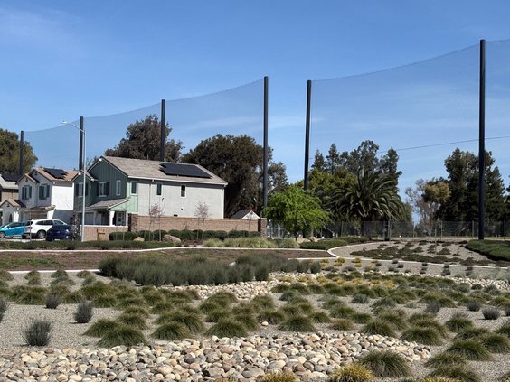
Many newer neighborhood parks are getting larger with the storm basin aspect altered to allow for natural drainage in park with crushed rock and landscaping along with recreational components.
The drainage ditch that sends runoff from the area south of the golf course is being kept as open space with spots fashioned into landscaped percolation basins with grass at a minimum.
As such, it aligns more with the valley’s Mediterranean climate, water conservation dictates, and the need to drain flat land during times of sustained or intense rain.
It should be noted the street flooding that occurred in the 99-home Yosemite Greens neighborhood adjacent to the golf course and north of the drain that feeds into the French Camp Outlet and ultimately the San Joaquin River, did not happen last November because of improper design.
The city was able to determine that construction crews at a nearby development had inadvertently blocked flows.
Perhaps the biggest opportunity being offered for recreation use regarding taming water is the $475 million 200-year flood protection project.
It is designed to enhance flood protection for southwest Manteca, Lathrop, French Camp, and the Weston Ranch area of southwest Stockton.
The plan calls for a paved path atop an extended cross levee starting in the east at Tinnin Road and running to the San Joaquin River levee.
The river levee also will have a paved path that would allow access to Mossdale Park.
It would connect ultimately with the Manthey Road river crossing to reach what will be an 18-mile paved bike/walking trail encircling the 15,001-home planned community of River Islands.
As such, it presents Manteca with the ability to connect city bicycle paths and/or separates lanes into a larger, semi-regional trail.
To contact Dennis Wyatt, email dwyatt@mantecabulletin.com