By allowing ads to appear on this site, you support the local businesses who, in turn, support great journalism.
TORMENTED RIVERS
LA may have ravished the Owens River but SJ farmers dried up the San Joaquin
thousand island lake
Thousands Island Lake — the headwaters of the middle fork of the San Joaquin River — as seen just off the Pacific Crest Trail at 9,840 feet in the Ansel Adams Wilderness.

Editor’s note: This is an on occasional series on California’s water issues, storage and conveyance systems as well as the current drought.


JUNE LAKE — 
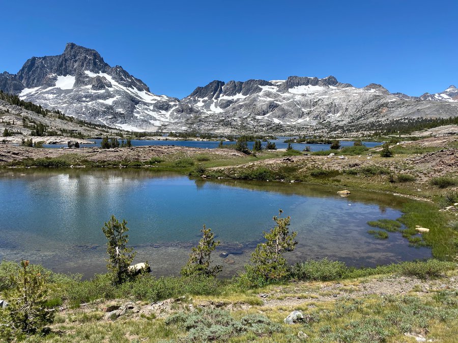
Go 120 miles as the crow flies southeast of Manteca and you will find the headwaters of two of California’s most tormented rivers — the San Joaquin River and Owens River.

The 183-mile Owens River starts from Glass Creek on the southern face of the 11,597-foot San Joaquin Mountain. Today instead of ultimately flowing into Owens Lake that just over 100 years ago covered 108 square miles and was teeming with aquatic life and migratory birds, the lake is a dusty shell of its former self.

The Los Angeles Department of Water and Power diverted much of the eastern Sierra runoff that feeds the Owens River into the LA Aqueduct to support growth beyond the ability of local hydrology to support in the Los Angeles Basin. In doing so it created the biggest dust source in all of the United States creating operational problems for the nearby China Basin Navy Air Base and even interfering with commercial jet traffic as dust plumes shoot skyward beyond 20,000 feet.

Los Angeles is now trying to irrigate 27 square miles of the lake that once ranged in depth from 23 to 50 feet to combat dust and restore some wetlands.

Before queuing up the usual Greek chorus about Southern California commandeering Northern California water supplies and making life difficult for those living and farming in water basins hundreds of miles away, four miles to the northwest of San Joaquin Mountain you will find Thousand Lake Island at 9,840 feet and within view of Mt. Lyell — the highest elevation in Yosemite National Park at 13,114 feet.

The aptly named lake reached by a 14-mile round trip hike out of June Lake serves as the headwaters of the middle fork of the 366-mile San Joaquin River.

Nature created the river to flow into the Delta where it meets up with the Stanislaus River 10 miles south of Manteca. But starting in the 1940s with the advent of Central Valley Project (CVP) to secure irrigation water for fertile yet dry farmland in much of the Southern San Joaquin Valley that is the epicenter of the most prolific ag production region in the world, some 60 miles of the river below Friant Dam and before the Merced River that flows through the heart of Yosemite Valley joins up with it started drying up each summer.

That occurred not just in drought years but in years of abundant snowmelt. It wasn’t until six years ago that snowmelt feeding Thousand Lake Island was able to again join up with the Merced River and flow past Manteca and Lathrop into the Delta as it did for thousands of years. It was made possible by a complex pact engineered by federal and state agencies, irrigation districts, agricultural interested, environmental groups, and sport fishermen.

Long before the current drought, both rivers have been on life support thanks to California’s complex conveyance systems.

Today’s drought is made more daunting by manmade plumbing that’s essentially re-engineered nature allowing water captured behind Shasta Dam outside of Redding to flow from water faucets in San Diego some 600 plus miles away.

It is further complicated by water rights dating back to the Gold Rush era, subsidence, court mandated minimum fish flows, riparian water rights, overcommitted water delivery contracts for cities and farms from the CVP and State Water Project, the fact there are 1,286 water districts throughout California, and groundwater still being pumped at will although the state has put in motion edicts for regional management of underground water supplies.

New surface storage opportunities are limited. They also come with environmental issues.

Desalinization of seawater is expensive and has a host of environmental concerns as well. But at the same time desalinization of brackish water sometimes more than 50 miles inland has been found to be less expensive and less problematic when it comes to the environment.

While many believe that droughts are local issues, the huge water transferences and an A to Z repertoire of issues means a decision to address a waste-related issue in the Delta can reverberate all the way to San Diego in the south, the Cascade Range watershed to the north and the western Sierra slopes to the east.

And perhaps nowhere in California is the impact of water decisions made along the shores of the Potomac River, at the State Capital, in courts, or within the expansive boardroom of the Metropolitan Water District that wheels water to much of the south state felt as hard as in San Joaquin County and the rest of the Northern San Joaquin Valley.

That’s because of a number of things.

*Some 70 percent of all water in California that moves in any given year flows through the Delta to faraway cities and irrigation districts as well as the ocean.

*The use of Stanislaus, Merced, and Tuolumne River watershed runoffs are being eyed as sacrificial solutions to address minimum fish flows during the current drought.

*Groundwater is being over-drafted and land subsidence occurring although not nearly on the scale of the Southern San Joaquin Valley.

*The New Melones Reservoir on the Stanislaus River is the most overcommitted reservoir in terms of water contracts in the state. Even in wet years the last CVP reservoir to be built that started filling up in the 1980s doesn’t have enough output from its hydrology to meet the delivery promises of all of its water contracts.

*Vernalis — the juncture of the San Joaquin and Stanislaus rivers south of Manteca — is where court rulings and legislative mandates have established a wide array of requirements for water ranging from fish flows and temperatures to dissolved oxygen levels.

*Much of the flow of the Tuolumne that once helped fish into Delta before being diverted to cities since the 1920s has bypassed the largest estuary on the Pacific Flyway for the benefit of San Francisco through the original Delta tunnel — the gravity pipeline that takes water in the Hetch Hetchy reservoir — built by the City of San Francisco thanks to Congress allowing the flooding of a national park to power urban growth.

*The Calaveras River has been harnessed to supply East Bay cities impacting that river as it flows through the county.

*The less fresh water flowing into the Delta not only creates riparian salinity problems in surface water supplies but was detected in wells as far east as Jack Tone Road during the 1989-1992 drought.

*Cities in the Northern San Joaquin Valley have some of the highest per capita water uses in re state driven primarily by the largest crop in California — ornamental lawns.

Those are just part of the issues that must be forged as California deals with what is shaping up to be the worst drought in at least 40 years.


To contact Dennis Wyatt, email dwyatt@mantecabulletin.com