River Islands is modifying its plans in a manner that will increase flood stage capacity in the San Joaquin River.
The solution is allowing them to proceed with creating 300-foot wide levees that easily surpass 200-year flood protection to allow work to start on 2,000 more homes of the 11,000 housing unit project. It means they won’t have to wait for federal approval that would take at least three years to get permission to widen existing levees by building a parallel levee next to it and then filling in the gap.
In doing so, River Islands will also be able to fulfill its objective of restoring riverside habitat that state and federal agencies had previously nixed.
The solution involved building a completely new 300-foot wide levee a substantial distance behind the existing levee. Then when the approval process is finished to allow the original levee to be modified within the next three years or so, it will be knocked down and the dirt spread in the area between the new levees and the river. That would essentially duplicate natural “benches” that exist in areas where the river is not simply flowing between levees on each side of the water.
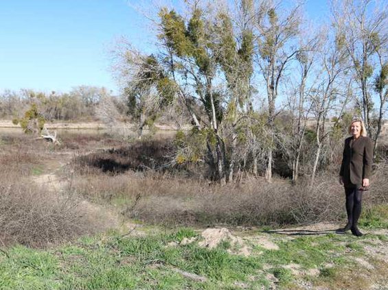
It will allow River Islands to plant native trees and such on the benches as long as they are 20 feet away from the toe of the new levee as required by law. It will create more low key river access points for the general public regardless of where they live that will be allow access from the 18-mile trail that will encircle River Islands. Besides providing a riverside habitat for various species, in times of flood flows high water will spill onto the benches taking pressure off the main channel.
As an added bonus the benches will be able to make the 300-foot wide new levee more bullet proof as water would never directly lap at its toe which is where boils develop that can ultimately undermine the integrity of a levee.
Project Manager Susan Dell’Osso said River Islands is now in the process of obtaining certification of the new 300-foot wide levee to allow another section of 1,000 homes to be built.
River Islands was able to start building homes by getting around the long approval process that could have taken an additional 10 years to modify the existing levees on the eastern end of Stewart Tract by creating essentially a parallel levee and then filling in the gap between the two levees. That allowed construction to start almost three years ago allowing 400 families to move in so far with another 700 lots about to be released to nine builders.
Dell’Osso said Cambay Group projects 500 homes will be sold annually in the coming years.
The firm decided to use a “compartmentalized” approach to levee expansion to put flood protection in place for the next large chunk of home sites being created. The idea originally was to knock down what would typically be called cross levees as the main super levee is extended. But now most of the cross levees will remain in place to provide additional green belts as well as some land height variance in the overall project that will eventually have 11,000 homes built.
The 18-mile green belt ringing River Islands not only will have California’s most unparalleled river access for the public but it will be continuous thanks to a decision to build bridges over the three access roads that ultimately will be built to the island. Cambay Group may do the same thing on the “cross levee” greenbelt that would cut across the development meaning pedestrians, bicyclists, and runners would never have to worry about traffic while using the greenbelt.
The benches — which will be created along the Old River — are essentially a bonus when it comes to increasing flood capacity.
Paradise Cut work
still waiting approval
going on 15 years
Twenty-one years ago when levees along the San Joaquin and Stanislaus rivers broke in 11 places and flooded 70 square miles southwest of Manteca, federal and state officials promised to move at lightning speed to find more ways to reduce future flood risks.
One solution that everyone including the Army Corps of Engineers agreed would significantly reduce pressure on levees by lowering water level by 1.8 feet during floods involved modifying Paradise Cut that runs under Interstate 5 between the Manthey Road interchange and the Interstate 205 junction. Cambay Group, the developers of the 11,000 home River Islands planned community, submitted an application in 2003 to get an OK to do the work. The Army Corps told them it would be approved in about 18 months. Fifteen years later, River Islands is still waiting for approval.
Paradise Cut has historically taken pressure off the San Joaquin River when it nears flood stages. It has little water in it much of the year.
River Islands’ proposal is to add 200 acres to the 600 acres that are within Paradise Cut that runs from the main river channel prior to it reaching Mossdale Crossing and runs parallel to the Middle River Channel. They also want to restore habitat.
The River Islands project is based on a proposal made years ago that resurfaced in 2001 in an Army Corps of Engineers report to create a river bypass to reduce the potential for flooding in Manteca, Lathrop, and Stockton.
The Lower San Joaquin River Flood Bypass Proposed was formally submitted to the California Department of Water Resources in March 2011 by the South Delta Levee Protection and Channel Maintenance Authority and other partners. It was an effort to secure $5 million to create the new flood bypass in the last corridor of undeveloped land between Tracy and Lathrop.
Engineers determined expanding the Paradise Cut would reduce flood stages significantly at Mossdale Crossing — 1.8 feet under a 50-year event as well as under a 100-year event such as the 1997 flood that inundated 70 square miles between Manteca and Tracy.
At the same time it would offer habitat and migration territories for juvenile steelhead, salmon and spawning split tail that are driving some water use debates.
It would also allow upstream reservoirs such as Don Pedro and New Melones to be managed more conservatively to reduce water releases during the rainy season and spring runoff to conserve water for summer use.
To contact Dennis Wyatt, email dwyatt@mantecabulletin.com
REDUCING SJ RIVER FLOODING
River Islands creating more flow for high water