The last line of defense for hundreds of Manteca homes against periodic flooding from river levees that have failed 11 times since 1929 is being strengthened by the developers of The Trails of Manteca.
The Planning Commission Tuesday gave their blessing to the 1,650 housing units the project will create on the western end of Woodward Avenue directly across from the Oakwood Shores neighborhood in southwest Manteca.
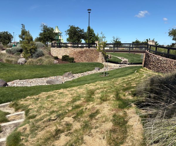
Developers will widen a 5-foot high cross or dry levee by 30 feet along the portion that runs through their project.
The cross levee that runs all the way to Airport Way was last put to the test in the floods of 1997 when levees along the Stanislaus and San Joaquin rivers failed flooding 60 square miles south of Manteca. State Office of Emergency Services crews covered the levee with plastic and monitored it 24/7 for four days worried it would fail and flood portions of Manteca southwest of Sierra High.
They even went as far as plugging the McKinley Avenue undercrossing of the 120 Bypass with a wall of 10 feet of dirt to serve as a backup emergency levee to protect urban Manteca. Should the levee fail today after the river levees gave way, hundreds of homes built since 2000 south of the 120 Bypass along the Airport Way corridor would be flooded.
Part of the environmental study for the Trails of Manteca had the levees being inspected by various agencies and engineers. The bottom line was if the levee currently meets flood protection standards. The developers though wanted to enhance the levee to remove any concerns.
Trails of Manteca will include 1,178 single family homes, 192 townhomes, and 280 apartments. It includes 75 acres of open space.
The Planning Commission Tuesday gave their blessing to the 1,650 housing units the project will create on the western end of Woodward Avenue directly across from the Oakwood Shores neighborhood in southwest Manteca.
Developers will widen a 5-foot high cross or dry levee by 30 feet along the portion that runs through their project.
The cross levee that runs all the way to Airport Way was last put to the test in the floods of 1997 when levees along the Stanislaus and San Joaquin rivers failed flooding 60 square miles south of Manteca. State Office of Emergency Services crews covered the levee with plastic and monitored it 24/7 for four days worried it would fail and flood portions of Manteca southwest of Sierra High.
They even went as far as plugging the McKinley Avenue undercrossing of the 120 Bypass with a wall of 10 feet of dirt to serve as a backup emergency levee to protect urban Manteca. Should the levee fail today after the river levees gave way, hundreds of homes built since 2000 south of the 120 Bypass along the Airport Way corridor would be flooded.
Part of the environmental study for the Trails of Manteca had the levees being inspected by various agencies and engineers. The bottom line was if the levee currently meets flood protection standards. The developers though wanted to enhance the levee to remove any concerns.
Trails of Manteca will include 1,178 single family homes, 192 townhomes, and 280 apartments. It includes 75 acres of open space.