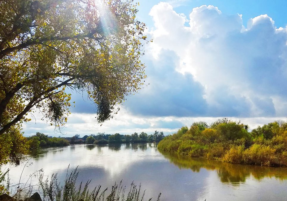

Manteca’s best kept secret when it comes to recreation is also the most obvious — river access.
That includes swimming beaches complete with sand, campground and picnic areas, walking trails, and fishing.
The odds are the 97,000 plus people that call Manteca home don’t even give much thought to the San Joaquin River even when they are crossing it on Interstate 5 or the Stanislaus River when passing over it on Highway 99 between Ripon and Salida.
There are no less than eight access points along the Stanislaus River from Oakdale to its confluence with the San Joaquin River seven miles south of Manteca.
Along the San Joaquin River there are three access points — four if you count the makeshift access by the Airport Way — in Manteca as well as Lathrop.
Yes, that is in Manteca – well, almost.
One of the spots that most people overlook is less than a quarter mile outside of the city limits where Woodward Avenue turns into a S curve past the Oakwood Shores gated community where it turns into Williamson Road.
This where you will find Turtle Beach Resort along a bend in the San Joaquin River.
It’s surrounded by the San Joaquin River on three sides, thanks to a backwater that creates areas suitable for swimming complete with beaches.
Turtle Beach Resort is part of the Thousand Trails system.
It is a well-kept area with plenty of grass and shade that offers RV spaces and campsites.
Yes, there are fees, and it is not a public day use park.
That said, there are Manteca residents that are familiar with it that will book weekends or multiple midweek days there to enjoy the peace and tranquility along the river.
It is a perfect respite in Manteca’s own backyard.
Turtle Beach is open year round and books up fast in the summer. In fact, it is already booked for much of June.
It is popular for fishing and low-key family fun with plenty of open space, boat launch, showers/bathrooms, and more.
You need to be a registered camper and pay for privilege to use what is arguably the nicest — and quietest — access to the San Joaquin River in the 209.
Membership in Thousand Trails, however is not required.
Other San Joaquin River access
The next best thing — and to be honest it is minimal and spartan compared to Turtle Beach — for river access is Does Ries Regional Park that’s part of the San Joaquin County Park system,
It offers RV camping ($50), weekend only tent camping ($40), and has day use that is $5 weekdays and $6 weekends.
RV cand camping fees are roughly $10 less than at Turtle Beach with an area that’s a sliver the size and is spartan with the added fact there is no hiding the levees that keep the river in its channel.
There are 2 RV sites with full hookups, showers and flush toilets, fire rings, picnic table w/lattice shade cover, boat launch ramp, horseshoe and playground.
It’s located at the end of Dos Reis Road as you go up over the levee.
There is also the Mossdale Crossing boat launch the county operates off of Mathney Road by the old truss bridge.
The Airport Way bridge is popular with many that like fishing and families that like the idea they can frolic along the river. That said, the current is strong just as it is at Mossdale and Does Ries making them all treacherous for swimming.
Caswell State Park
The coolest spot to enjoy summer along the Lower Stanislaus River is Caswell State Park that is at the end of Austin Road south of Manteca.
Not only does the thick canopy of oaks drop the temperature by 10 degrees by the time summer rolls around but when the evening Delta breezes kick in Caswell becomes even cooler.
And if you're looking for a good old-fashioned dip in a river with very clear water, Caswell has two popular beaches — Willow Beach and Salmon Bend Camp Beach.
Willow Beach is by far the main attraction. Ironically, you'll find more Bay Area folks taking advantage of the natural swimming along the Stanislaus River at Caswell than you will nearby residents.
Currently. the weekend crowds are fairly light but that will change as temperatures start their annual climb to the 90 degree mark and beyond.
Water levels are reasonable and the water will soon warm enough to swim, float, or play beach volleyball. Be warned, though, that New Melones Reservoir releases could change the situation although flows aren’t likely to get much higher than they are now.
You will not find another public beach-river combo in the 209 as pleasant with a definite lazy feel although the Stanislaus between Knights Ferry and Caswell have some pleasant access points where you can have shaded water play such as McHenry Recreation Area south of Escalon off River Road.
But they don't have the beach or the expansive woodlands complete with trails to explore. Nor do you have very many options for camping as you do at Caswell.
The day use fee is $10 and $2 higher on weekends and holidays.
In addition to camping, fishing and guided nature trail facilities, the park also can be reserved for big and small school groups looking for a field-trip destination.
However, here’s a reminder for those who are planning to visit the park in the spring and summer months: make your camping reservations early.
The campsites are typically sold out a week or two in advance from mid-May to September
To avoid the rush, make your reservation early. The park can take reservations up to seven months in advance.
For camping reservations and park information, call 1.800.444-PARK.
For information about reserving the park for school field trips, call the park office at 209.599.3810.
Ripon river access
You don’t have to travel far for a peaceful woodland stroll along the river.
Ripon’s Stanislaus River Park recreation area is a textbook example of the right way to develop urban access to nature without leaving a city.
The Ripon recreation area is the closest spot to Manteca to go walking in a natural wooded area by the river without paying or trespassing. It is located just seven miles south of Manteca and visible from busy Highway 99.
The addition of the pedestrian bridge that was imported from Alabama and placed over the Stanislaus River not only opened safer bicycle access to Stanislaus County but created a pleasant stroll for walkers of all ages.
There is a small parking lot that can be accessed by taking the Main Street exit off southbound Highway 99 in Ripon. Turn left to go over the freeway and once you reach the stop sign by the Starbacks, turn left and then quickly turn right onto Parallel Avenue. That will take you right to the parking lot.
The paved trail is stripped for bicycle use so the basic rules apply — walkers on the right and bicyclists pass on the left with polite warnings. The gentle drop down to the bridge is easy to navigate. Once on the bridge, you get a nice view of riparian woodland and can enjoy the textures of the water passing below.
Granted, the view to the west could be a bit better but a freeway is a freeway. It doesn’t take long before you’re lost in the magic of nature. You’ll find yourself pausing for long periods on the bridge which has a cyclone fence attached to the trusses for added protection.
You can continue south into Stanislaus County, if you wish, but most walkers undoubtedly will be tempted to head toward the slight hill on the north side and take one of two dirt trails. Ultimately, you could reach Ripon’s Mavis Stouffer Park if you’re adventuresome. But you don’t have to go far until you can come to a quiet spot on the river’s edge where you can enjoy the timeless pastime of tossing sticks, leaves and rocks into the river.
On the main trails you will encounter mountain bikers form time-to-time, but when you head toward the river’s edge, the path is a bit precarious leaving the two wheelers behind.
There are chemical bathrooms near the parking lot. You will have to bring your own water, though, whether you stick to walking by the river or venture by bicycle toward Salida.
Stanislaus River Parks
The lower Stanislaus River has an extensive Park System that is well maintained by the Army Corps of Engineers and open to public use.
Knights Ferry Recreation Area, the put in for rafting trips, is a sprawling park that includes multiple picnic table and BBQ sites, river access, extensive hiking trails, and access to the oldest covered bridge west of the Mississippi River.
Knights Ferry Recreation Area also is home to the Army Corps of Engineers local museum that includes local history displays as well as that of local flora and fauna. A great place to spend an afternoon checking out relics from the gold rush or to just relax along the river.
Next in the park system is Horseshoe Park, another large park about 4 miles downstream of Knights Ferry. Access to this park is off of Orange Blossom Road.
The park includes riverside picnic tables, options for overnight camping, and river boating access. Horseshoe Park is a popular place for recreational boaters and kayakers to have lunch, and during weekends because a busy spot for those looking to cool off, fish, or BBQ.
Permits are needed for overnight camping and can be found through the Army Corps of Engineers at 209-881-3517.
Orange Blossom Park is a large grassy park that is free for the public to use and located just 5 minutes east of Oakdale.
The park is a common recreational boat use area, and is the location where many commercial rafting trips end. The park includes large group sites for picnicking and BBQing that can be reserved in advance. While this park is among the most beautiful on the Stanislaus River, parking is limited, so make sure you show up early on busy days in order to nab a spot.
Between Orange Blossom and Oakdale Recreation Area is a small river-access only campground called Valley Oak.
The secluded site harbors multiple group sites and is perfect for groups looking for a more secluded camping experience right along the river. Restroom and BBQ access points are located within the park.
The next park in the Stanislaus River Park System is Oakdale Recreation Area. This park stretches along nearly a mile of the Stanislaus River, and is unique in that it also houses a number of small stocked ponds. Because of this most of the frequenters of the park are fishermen, as picnicking areas are few and far between.
Another great place for river access is the Oakdale Recreation area that is visible to the north as you cross into Oakdale on Highway 120.
The town of Riverbank surrounds Jacob Meyers Park, another large grassy piece of property along the north bank of the river.
Revamped in the last decade, the park houses a boat ramp and a large playground for kids. Picnic tables, BBQ pits, and drinking water fountains are all available to the public.
The rustic zone of the park covers over 40 acres and includes a mile-long walking/biking loop as well as a group campground.
At the end of the Stanislaus River Park system is McHenry Recreation Area on River Road south of Escalon.
The recreation area contains multiple trails along the river, as well as some secluded camping sites that can be reserved.
Picnic areas are dispersed throughout the park as well. In the busy summer months this park gets impacted as well, so early arrival times are recommended.
The Stanislaus River park system provides multiple areas for adventurers to camp. The main areas are at Horseshoe Park, Valley Oak Recreation Area, and McHenry Recreation Area.
All of the parks on the Stanislaus River Park system can be reserved by going to https://www.recreation.gov/gateways/477 and scrolling down to the desired campsite.
All of the park campgrounds are maintained by the Army Corps of Engineers, and provide access to restroom facilities (but not showers). Rates vary based on group size..
Horseshoe Park and Valley Oak Recreation Area are, compared to a lot of other parks in Northern California, incredibly quiet for riverside camping.
The campgrounds are rarely packed, except for on holiday weekends.
To contact Dennis Wyatt, email dwyatt@mantecabulletin.com