
Ten miles away as the crow flies from the platinum standard of current California levees — the 300-foot wide super levees protecting River Islands at Lathrop — is where 20 Mormon pioneers learned the hard way that trying to settle and farm in or near the Delta without first controlling water was an exercise in futility.
The Mormon bid to establish a colony in 1846 was the first effort of its kind in the Delta region. Under the leadership of William Stout they picked a location on the Stanislaus River around where Caswell State Park is today about 1½ miles upstream from its confluence with the San Joaquin River.
They completed a central house and had cultivated and fenced 80 acres of wheat by the middle of January 1847. The coming of heavy unseasonable rains that triggered an early Sierra snowpack melt — the same conditions that led to the 1996 Manteca floods — saw the river rise 8 feet an hour and quickly overflowing its banks. The land was flooded for miles. The effort to establish a colony was abandoned.
Today 171 years later those who farm and live south of Manteca are well aware of the devastation the rivers can bring. With 11 levee failures along the Stanislaus River to the south and San Joaquin River to the west since 1929 and a number of close calls including February of 2017, those residing and/or earning a living in the 100 year flood plain know it isn’t a question of “if” the levees will fail, but “when.”
It is why they are more than apprehensive about what will be the largest public works project the cities of Manteca and Lathrop have ever participated in — the effort to strengthen levees to address 200-year flood protection as mandated by the state.
The ultimate tab could exceed $180 million with a large part of the cost covered by fees charged to development.
Sacrificing those south
of the new cross levee
for those north of it
in a 200-year flood event
From the perspective of longtime agricultural businessman and farmer Marty Harris and many others, they will ultimately end up suffering even bigger flood losses once the improvements being pursued by the two cities along with Stockton and San Joaquin County are ultimately put in place.
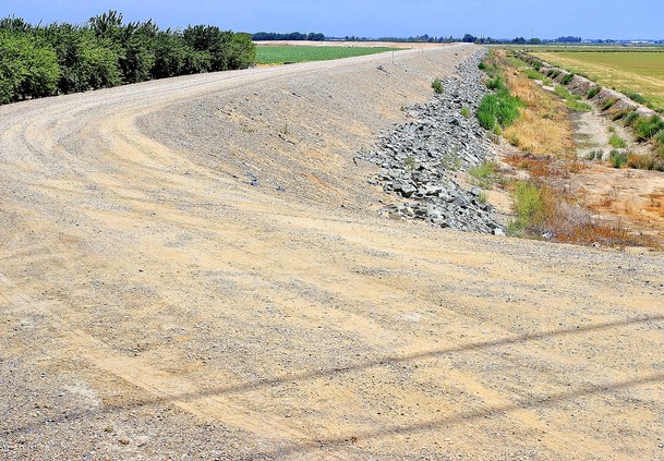
That’s because a key component is extending and raising a cross of dry levee that now runs from near Airport Way toward the San Joaquin River south of Woodward Avenue.
Simply put when the levees south of Manteca and Lathrop fail the cross levee in a 200-year event — a flood that may not happen every 200 years but instead one that has a 1 in 200 chance of happening in any given year — will protect 50,000 residents in Lathrop outside of River islands, Weston Ranch in Stockton, southwest Manteca, and rural areas and flood 4,200 existing homes with 3 feet or more of water in those areas.
A wider and higher cross levee in the event of a 200-year flood event means that water will not breach the existing cross levee and water will rush northward to swamp the wastewater treatment plant serving 81,000 existing Manteca residents and more than 15,000 of Lathrop’s nearly 25,000 residents as well as force the closure of Interstate 5 and disrupt Union Pacific Railroad traffic. Instead it will back up south of the cross levee raising water higher and spreading it more to other low lying areas to the east. It would basically exacerbate flood damages south of the dry levee.
Or as one resident put it during a council meeting last year, it will sacrifice the well-being of those south of the pumped up cross levee to protect those north of the cross levee by increasing property losses proportionately.
In July the Manteca City Council made annual findings that they have made adequate progress toward getting enhanced flood protection in place as required by state law. The other jurisdictions involved in the process did as well. Their collective findings have been accepted by the state.
The cities including Manteca are under the gun to get a project moving forward by 2022 that is ready to break ground. Manteca and Lathrop already have funding mechanisms put in place as required by the state to make that happen.
Because of that, growth can continue in the designated 200-year flood plan north of the cross levee can continue.
Exact path of cross
levee could have other
negative impacts
Owners of property closest to the city have another quandary that could inflict more financial damage or disrupt their lives more that the possibility of a 200-year flood. The exact path of the dry levee has yet to be established. Where it goes could split some properties, devalue property, and create a situation where people could get on top of the levees for various purposes even if it is illegal to do so to disrupt privacy and such.
While the 200-year flood protection plan estimated to cost nearly $180 million will enhance levee protection along the river, it won’t on the most vulnerable levees in all of San Joaquin County — those protecting the farmland south of Manteca, west of Ripon, east of the San Joaquin River and north of the Stanislaus River.
That’s because the area is protected by a different reclamation district. The work to shore up — as well as upgrade to 200-year protection — on those river levees could easily exceed $100 million, something property owners in the area could never afford to pay for even using long term bonds.
Delta farmland and several cities such as Lathrop, Stockton, and the western portion of Manteca along Airport Way would likely not exist if it weren’t for levees protecting them from what was once almost annual flooding.
There are roughly 1,115 miles of levees in the Delta with the first being built in 1850. Farmers initially thought they could protect their land with levees that were 4 feet high and 12 feet wide at the base but quickly saw that as a folly.
Manteca fees in place
to help pay for work;
ongoing assessment
is also possible
Those buying the 2,200 new homes that ultimately will be built in the 200-year floodplain in parts of western Manteca impacted likely will have no inkling of the mechanics of levees or their history. That said they will be paying a price.
Manteca adopted its interim levee impact fees that cover new construction within the 200-year flood zone in March of 2017. Those fees are:
$3,145 for a single family home.
$1,417 per 1,000 square feet of commercial.
$1,096 per 1,000 square feet of industrial.
$904 per unit of multiple family complexes.
Those fees at build-out are expected to generate $13.9 million. Unless federal or state funding falls into the city’s laps, the odds are a benefit assessment district (BAD) will be pursued.
Should that happen the formation of a BAD would be a forgone conclusion. A BAD could be created by owners of developable land outvoting owners of existing homes and businesses since California law requires a vote of property owners weighed by the amount of land they own and not by registered voters.
It requires a public hearing that also serves as a protest hearing. If the majority supports its formation at that time the district can be formed.
Without the BAD, the raw land cannot be converted into housing. That would mean new homes would be hit twice: First for fees when the building permit is issued and then again if and when a BAD is put in place.
Critics have noted the state doesn’t require levees to be upgraded unless cities want to allow new construction that didn’t have specific approvals by July 1, 2016.
But the odds of the city not pursuing 200-year flood protection have always been next to none regardless of the desire of residential developers in southwest Manteca.
That’s because a 200-year flood would inflict major damage on existing development and public facilities.
While formation of a BAD would only directly impact a relatively small handful of Manteca homes already in place, part of the cost — although a comparatively small share — would be covered by all homes and businesses in the city. That’s because whatever share of the overall cost is assigned to the large acreage the city owns at the wastewater treatment plant should a BAD be formed would be charged off to city sewer customers.
The area where the interim fee applies is everything west of the Airport Way corridor on both sides of the 120 Bypass and the land to the east of Airport Way south of the Bypass to a point roughly halfway to Union Road.
To contact Dennis Wyatt, email dwyatt@mantecabulletin.com

