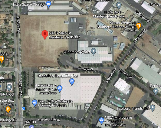
There will be no “feasibility” study for a homeless navigation center that could also have a drop-in shelter on 8.04 acres along South Main Street.
Making it clear that the South Main Street location is the site they want, the Manteca City Council last week authorized setting aside $150,000 for a study to determine what is needed for homeless services as well as conceptual plans will telling staff not to refer to it as a “feasibility study.”
“We spent two years on (the) Qualex (property) and we didn’t get anywhere,” Mayor Ben Cantu noted.
Cantu said that is why attaching the word “feasibility” to the study was a non-starter for him.
Councilman Gary Singh said the site is clearly the best site given:
*the city could control how it is configured.
*it’s location in relation to the homeless needing to access it.
*the fact it has emerged as the least expensive option.
*can be designed from the start to minimize impacts on the community.
*it can be split so that affordable or transitional housing could be pursued along South Main Street.
*access could be from Carnegie Court off of Mellon Avenue within the Manteca Industrial Park.
“We have got to figure a way to make it work,” Singh said.
The study will cover financial implications, assessing building space needs, and the needed homeless services. It will include workshops to obtain community input.
The city staff has already started work on the appraisal for the South Main Street location as well as an environmental site assessment that will identify any pollution issues.
To contact Dennis Wyatt, email dwyatt@mantecabulletin.com