
Apparently Manteca plans to build what could be a growth-inducing “parkway” in a 100-year floodplain where levees have failed 11 times since 1929.
That means if the levees fail along the Stanislaus and San Joaquin rivers south of Manteca as they have an average of once every 8½ years it would be at risk of being covered by floodwaters. The area in question was underwater in the 1997 floods.
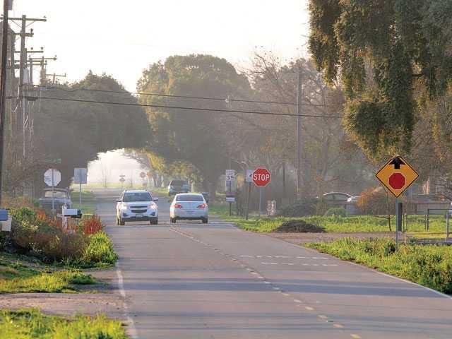
The controversial Antone Raymus Expressway — now being marketed as a parkway — would infringe on fertile farmland south of Manteca that is not within the city limits.
That was made clear during Tuesday’s city council meeting by City Engineer Leigh Ann Sutton in response to questions from Manteca Mayor Ben Cantu regarding the alignment.
Cantu, a longtime proponent of the expressway, said he asked Sutton to research the issue when she joined the city after it created its own engineering department last year.
Sutton noted the new general plan update that the City Council has yet to adopt has the Antone Raymus Parkway going from the McKinkey Avenue/120 Bypass the city expects to break ground on in the next few years and swinging in a southeasterly direction to connect with a proposed $100 million interchange on Highway 99 midway between Austin Road and Jack Tone Road interchange.
Raymus Expressway
would go over levee
The roadway will go over the cross-levee that is part of a $180 million project to upgrade flood protection from 100-year to 200-year as mandated by the state. It will then go south enough to apparently avoid a concentration of small rural country estates along Fig Avenue and Peach Avenue and across farmland to head east. All of this area is not in the city limits nor is it supposedly on the city’s radar for future annexation.
The actual roadway is supposed to be six lanes for a brief stretch near the interchanges, then four lanes for a while and two lanes in the middle. Sutton said in lieu of traffic signals at intersections the plan calls for roundabouts in a bid to keep traffic moving but to slow it down as it passes through neighborhoods.
Antone Raymus Parkway, however, is advancing as a Trojan horse for an eventual expressway. That’s because the city is requiring enough right-of-way through new subdivisions as they are approved to possibly go back in the future and make it four lanes instead of two and replacing roundabouts with traffic signals.
That makes it appear the city’s plan is to simply silence expressway critics by appearing to address their worst fears that the proposed roadway could one day become a truck route to connect an approved 1,050-acre business park in southeast Manteca with the 120 Bypass at McKinley Avenue. The expressway was first proposed as a key traffic flow element for that business park that is envisioned to include large distribution centers.
In past years the county residents were joined by those in the city questioning the wisdom of building the expressway.
The under-the-radar approach to creating the Antone Raymus Parkway/Expressway is underscored by the fact the mayor had to ask if an alignment of some sort existed.
Parkway alignment
raises questions
The fairly short exchange that occurred while the council was approving final maps for a large portion of the 655-home Cerri development that abuts the parkway/expressway raises a number of policy and financing questions that city leadership has sidestepped or not addressed:
*Is it legal under Senate Bill 5 that mandates 200-year flood protection to be in place — or in process of being designed, funded and built — by 2030 to build major infrastructure such as a key city roadway in a flood zone that won’t have such protection?
*How will the city pay for the segment south of the city that cuts through the flood zone? City policy has been to make developers build segments of such major streets as growth occurs. But since growth can’t occur there due to the floodplain, how will the city pay for the road?
*If the intention of city planners — or whoever is assuming responsibility for general growth blueprint decisions in the area — is to eventually see the area urbanized, how will that happen since it is all outside the area being upgraded for 200-year flood protection?
*Does the city still need an Antone Raymus interchange on Highway 99 now that Caltrans is working on a three-phase $157 million 120 Bypass/99 interchange that breaks ground in the fall that includes a replacement of the Austin Road interchange with a much more muscular footprint that also clears the railroad tracks that wasn’t even on the radar when the city started looking at the Raymus interchange?
*How will the city pay for a Raymus interchange that essentially would serve future Ripon growth east of Highway 99 given land all the way north to Graves Road is part of that city’s sphere of influence which represents areas that are targeted for possible annexation? A previous city council dropped funding for that interchange and the Roth Road interchange that is part of the proposed general plan yet to be adopted because they were too costly and seen as repetitious. On either side of the proposed Roth Road interchange north of Manteca are two recently upgraded interchanges at French Camp and Lathrop roads.
*Exactly what are the city’s interchange priorities and how are they going to pay for them? The state is no longer funding interchange work that “induces growth” per se. The Raymus interchange has a $100 million price tag because it not only has to clear the railroad tracks but Highway 99 freeway lanes need to be shifted to the east to make it work. The city’s current major road fee for interchange work includes absolutely no funding to upgrade the Airport Way and Main Street interchanges along the 120 Bypass. Based on upgrades to a diverging diamond configuration at Union Road, such work will require at least $56 million.
Cantu has espoused a
loop road to ease
traffic congestion
From Cantu’s perspective, the city backing off publically on what he believes is a textbook planning issue of building a roadway that will move traffic quickly based on the projected growth was simply to appease opponents. That then, based on the mayor’s observations, puts future councils in the awkward position of remedying traffic problems that infuriate residents.
Cantu 20 months ago gave a glimpse of his vision for major roads “circling” the city as much as possible for optimum traffic flow much like major cities in Texas do. It came up at a workshop involving major arterials to the north and east of developed Manteca.
He saw such a road to the east of Manteca starting somewhere near French Camp Road and looping to connect to the Raymus interchange as providing an expressway with no or little development to get east of the roadway making it the de facto city limits. That would connect with the Raymus roadway south of Manteca to hook up with the 120 Bypass at McKinley.
It would effectively create roughly three quarters of a loop of Manteca. And without traffic from urbanization on most of one side of it, such a roadway would allow for muscular movement of traffic.
To contact Dennis Wyatt, email dwyatt@mantecabulletin.com

