Pity those that live along the San Joaquin River — including those that are in southwest Manteca and parts of Lathrop not within River Islands.
The dice is being rolled once again.
A powerful El Nino is coming our way.
Based on modeling by the National Oceanic and Atmospheric Administration that hasn’t been completely dismantled — but in all fairness has been routinely ignored by red and blue politicians for decades — the Northern San Joaquin Valley and Central Sierra are in for a potentially wild ride.
The NOAA notes there is a 33 to 40 percent probability for higher than normal temperatures this winter while precipitation has a 40 to 50 percent chance of being higher than normal this winter.
Can anyone say shades of 1997?
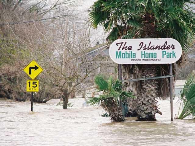
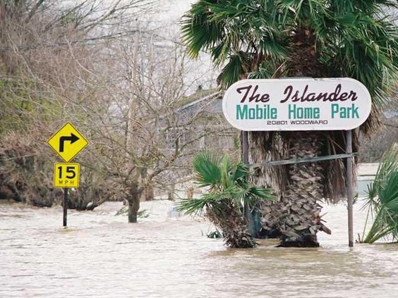
For those in southwest Manteca and Lathrop on the north side of the San Joaquin River and west of Interstate 5, the area you now reside barely dodged the bullet of being flooded with 18 inches to three feet of water.
The weakest link in the San Joaquin River — the bend at Mossdale west of the massive Wayfair distribution center — was riddled with boils.
A dry levee that California Conservation Corps crews covered with plastic had water just south of Woodward Avenue in the area in fast-growing southwest Manteca had water lapping at its top for a nerve wracking 60 hours.
Seventy-two square miles south of Manteca and east of Tracy were less fortunate.
They were flooded. Over 2,000 people were evacuated, roughly 800 homes and other structures damaged, and overall loses pegged at almost $100 million.
There was more precipitation than normal at the start of the 1997-1998 winter leaving the Sierra with a usually heavy snowpack by mid-December.
Then the higher than normal temperatures came.
By New Year’s Day there were real concerns major dams could be breached if the unseasonal runoff from the snowpack just a dozen or so days into winter continued.
That led to severely cranked up releases from New Melones on the Stanislaus River and Don Pedro on the Tuolumne River.
The first to flood was farmland on the wrong side of the levees between Oakdale and Ripon.
Then at 1:01 p.m. on Sunday, Jan. 5, 1997 a levee failed on Sturgeon Bend on the Stanislaus River near the confluence with the San Joaquin River just south of the Airport Way bridge.
There was not a cloud in the sky on that crisp winter day and it hadn’t rained for weeks in Manteca when the levee failed.
There were more than 11 breaks in the following days along the Stanislaus and the San Joaquin River almost all the way to the junction of Interstate 5 and the 120 Bypass.
It should be of some comfort to the bottomland farmers along the Stanislaus River there are now different release protocols in place at dams operated by both the Bureau of Reclamation and state Department of Water Resources based on analyzing the 1997 fiasco.
That said, it is still a roll of the dice. There is no such thing as an exact prediction with what an El Nino will do.
The reality is there is a large chance precipitation will be above average but more of it will be in rain than snow. Couple that with warmer early winter weather as a possibility and there could be a lot of water flowing between the levees on both the San Joaquin and Stanislaus rivers.
Enhanced flood protection that local agencies have been working on for years and affected Manteca-Lathrop-Weston Ranch property owners bought into via approval of a parcel tax last year, won’t be in place until 2032 or so.
The $475 million flood protection upgrade is a massive and complicated project that is moving along as fast as possible with the main drag being the multiple state and federal bureaucracies that it has to clear.
There are two reasons River Islands is protected with levees three feet higher than what the federal government wants after the Katrina catastrophe in New Orleans in August of 2005.
First, it was funded 100 percent by a private second developer.
Second, they found a way around bureaucratic rules that they invested nearly a decade of energy trying to navigate that ended up reaching the exact stated goal the federal government wanted.
It was done by building what essentially was a second levee parallel to the existing levee and then filling the area in between them that was compacted to create a 300-foot wide super levee.
The process took less than two years to complete.
Do not misconstrue this as a need to hit the panic button.
Instead, this is designed to take note of the hot air that state and federal politicians will bellow if something happens.
El Nino is an age-old phenomenon.
The solutions have been known for years
Sacramento — and to a less extent the federal government — has failed to deliver for decades whether it is repairing aging dams or fortifying levees.
If Mother Nature rolls snake eyes this time around, we won’t be prepared because of Sacramento.