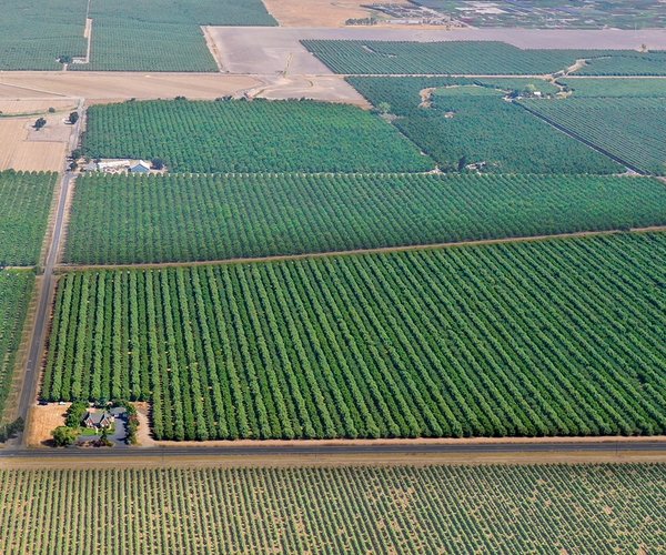
Gazing down from atop 3,489-foot high Mt. Diablo, the Sacramento-San Joaquin Delta levees below create a maze like patchwork of nearly 60 islands and tracts surrounded by water flowing toward the San Francisco Bay.
The 1,100 linear miles of levees was created after the Gold Rush to reclaim vast wetlands for farming. The soil — laden with extremely rich nutrients — is considered among the most prime farmland in California.
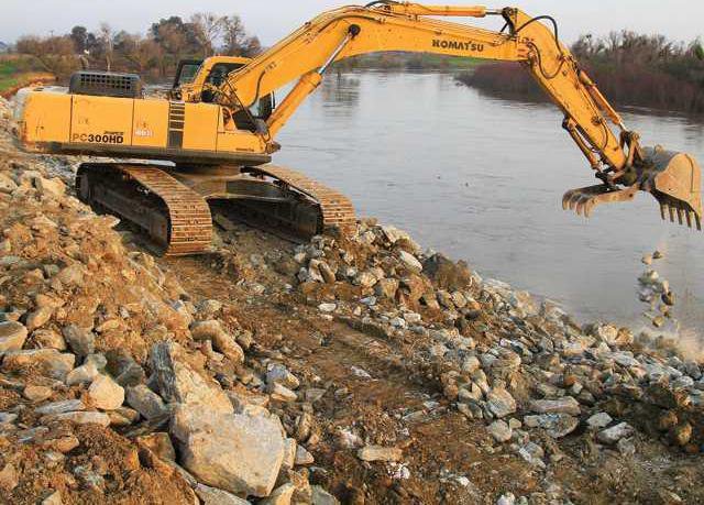
The levees were made by essentially dredging the adjacent river.
Today, as various weather models call for a strong El Nino weather event this winter that means warmer temperatures and more precipitation than normal, the Delta is — for the most part — protected by stretches of levees that haven’t changed much for 160 years.
The big caveat, of course, are levees upgraded 50 to 70 years ago protecting heavily urbanized areas such as Sacramento and Stockton but even those modifications — especially in the case of Stockton south to Lathrop and Manteca — are no longer acceptable due to increased runoff from the creation of more impermeable surfaces and shifts in weather patterns.
Arguably, the only levees fortified recently to meet more dependable stands of protection are those protecting the 15,001 home planned River Islands at Lathrop planned community.
The levees ultimately made it possible for California to develop the planet’s most elaborate — and lengthy — movement of water stretching as far as Shasta Reservoir to San Diego and covering more than 670 miles.
Without levees, some form of sea wall, or the proposed tunnel, it would not be possible to move drinking water for 63 percent California’s nearly 40 million residents through the Delta and into aqueducts to complete the trip to Southern California or the Bay Area.
Altogether, more than 70 percent of all water from developed sources such as reservoirs in the Sierra and Siskiyous moves through the Delta that Linden farmer and former State Senator Mike Machado once described as “the switching yard” for California’s water.
Parts of five counties — Sacramento, San Joaquin, Contra Costa, Alameda, and Yolo — are within Delta with the most land mass being in San Joaquin County.
There are 13 cities and five unincorporated communities that are home to some 550,000 people that are protected by the levee system.
The Delta today is essential not just for the delivery of drinking water for 25 million Californians but also to grow the state’s $64.7 billion crop production. It also serves as an important habitat for 750 plant and animal species.
Due to oxidation and wind erosion, there is widespread subsidence or sinking of land in many of the Central Delta islands. A large chunk of the Delta region lies below sea level today due to subsidence.
The Delta is part of the Central Valley that was once a great inland sea. In geological terms, the Delta is 10,000 years old essentially coming about at the end of the last ice age.
Without the levees, the Delta would revert to being massive freshwater marsh with low islands of peat as well as numerus shallow channels and sloughs. It would flood with spring runoff pushing saltwater back to the SF Bay. During late summer and into fall, seawater would push eastward.
The Delta covers roughly 1,100 square miles with Stewart Tract in Lathrop — where River Islands is being developed — as the southeastern most island/tract.
The Peripheral Canal scheme was revived as the Twin Tunnels (which is now just envisioned as a single tunnel) following the unexpected and sudden collapse of the Jones Tract in 2004 and the failure of levees in New Orleans in 2005 during the aftermath of Hurricane Katrina.
It prompted a controversial state study that contends a 6.5 magnitude earthquake in the Delta could cause massive levee failure The study estimated loss of upwards to $40 billion to the state’s economy.
Critics have pointed out that during major earthquakes in the past 160 years, levees simply acted like Jell-O-as many major buildings in San Francisco are designed to do during a major shaker.
They also noted there is no known active fault line in the Delta that scientists have identified being capable of generating such a large tremblor.
To contact Dennis Wyatt, email dwyatt@mantecabulletin.com