A hunter back in the late 1990s shot a rabbit along Paradise Cut on Stewart Tract.
After he skinned it and cooked it, the hunter thought the rabbit tasted funny as he took his first bite.
He made some inquiries. Researchers quickly were able to determine the endangered riparian rabbit thought to only live around Caswell State Park on the Stanislaus River had a bigger range than previously thought.
The first response of developers faced with the prospect of having their land designated as habitat for an endangered species would typically dig in their heels and fight for every inch they could get.
That wasn’t the case with River Islands at Lathrop.
They offered upfront to create a six acre Riparian rabbit habitat on Paradise Cut just off the San Joaquin River. When flooding threatened the lives of a Riparian rabbit colony, they helped save several dozen from drowning. And then they built a bridge across the river a significant distance from where Riparian rabbits were known to roam, they made sure the anchoring on the bridge on each bank was done in such a manner it would allow the riparian rabbit to travel with ease.
From plans to restore river side habitats and providing unprecedented universal access to the San Joaquin River to working to save an endangered species, reducing community vehicle trips by smart development, and maximizing water use and extraordinary steps to protect water quality River Islands at Lathrop has set the platinum standard for eco-friendly development in the Northern San Joaquin Valley.
The first home models for the 10,800-home planned community in 4,800 acres are targeted to open in May.
And when buyers sign sales contracts they will be doing so to purchase homes in a community designed to co-exist with — and to enhance — the environment.
14 miles of park
will run along
river, delta habitat
The biggest environmental success story, though, could very well be their plan to breathe new life into levees.
The entire 4,800 acres are surrounded by the San Joaquin River, the Old River and interconnecting waterways that fill with spring run-off or during floods such as Paradise Cut.
The initial phase of River islands represents a $70 million investment by Cambay Group for 300-foot wide super levees. They are literally in a class by themselves as no other levee system in the United States is designed to withstand a 200-year flood. They are in the process of being re-certified under new standards established by the Federal Emergency Management Agency. And unlike surrounding reclamation districts that are in the process of identifying how they can meet the 40 listed mandates, River Islands has just one point they have to address before being re-certified.
The current super levees were going to be replanted in native foliage and trees but a federal rule prevents that due to the slope. Future super levees that will protect the western end of the project will be designed with a shelf above the high water line that will be 10 feet deep to a point where the levees will continue their upward slope. It is on the shelf where vegetation and trees will be planted.
Most levees along the river tend to be simply dirt and lined with rock to prevent erosion.
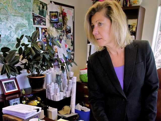
“We were shocked to see what the original levees were made of,” River Islands Project Manager Susan Dell’Osso said. “They used sandy soil.”
The dirt put in place is more appropriate for levees use and is significantly less susceptible to boils that are the precursor to breaks.
However, the sheer depth of the levees — they are 300 feet wide at the base — makes them virtually bullet proof to such failures.
Containing the San Joaquin River through levees starting more than 140 years ago meant that public access has been severely restricted. And although people routinely ride and walk on surrounding Reclamation District 17’s levees, they are trespassing.
River Islands is designing the 14 miles of levees around the community to be accessible to anyone regardless of where they live via a linear greenbelt park complete with paved bike paths. They are also placing public fishing piers in numerous spots along the river to allow access.
It is as much about wanting the public to make use of the river as it is to prevent people from using the private docks that more the 900 homes overlooking the river will have.
River Islands is mandating that builders landscape the front yards of all homes with moisture sensors to reduce water use.
The 400 acres of lakes are being lined with sandy loam so that impurities in storm run-off are captured before water seeps into the high water table and back into the river.
Common areas such as mow strips are being planted with plants that require less water.
The development is also designed to encourage walking to access amenities such as parks located with a quarter mile of all homes.
Dell’Osso noted River Islands has forged strong working relationships with environmental groups such as the Sierra Club, DeltaKeepers, and the National Resources Defense Council by understanding they share common ground when it comes to making sure a community is sustainable and co-exists as much as possible into the environment.
Rare rabbits matter at RI
10,800-home project offers universal river access