Instead of a “spine road” to take future and present truck traffic off Airport Way perhaps Manteca’s leadership might want to grow a spine instead.
How city leaders go about developing the Airport Way corridor for traffic movements will speak volumes about how realistic they are about truck movements, the guardianship of tax dollars now and down the road, how serious they are about being business friendly, how tight they cling to textbook planning in the face of realities that scream for pragmatic solutions, and how well they play with others — most notably Lathrop leaders.
First let’s get a myth out the way.
Airport Way was conceived and built as a two-lane rural road that for decades had traffic volumes arguably 3 percent of what they are today. The city has altered only short segments on either side of the 120 Bypass, at Lathrop Road and Louise Avenue, and segments south of Roth Road. The pounding of trucks hasn’t helped but most of the damage has been done by cars. The worst segments such as between Crom Street and Airport Way — haven’t been touched by the city except for a few potholes being filled in during the past 30 plus years the roadway has been under Manteca’s control. Before that the county didn’t do any significant work on the roadway for at least a decade.
Then there is the issue of the spine road to serve as a designated truck route midway between Airport Way and the railroad tracks that serve as the city limits shared with Lathrop. It is a great concept. The only problem is the city leadership that is advocating it was elected 20 years too late.
The expectation is that truck traffic originating from let’s say a possible new business park south of Lathrop Road and west of Airport Way will traverse four sets of railroad crossings (two to clear the Lathrop “Wye” and again crossing Yosemite Avenue by the ACE station and McKinley Avenue near Daniels Street), navigate a minimum of four stop signs or traffic signals, and make two turns once they are on the spine road to reach the 120 Bypass. That is as opposed to crossing one railroad track and four traffic signals (the new one going in at Crom Street is included) to reach the 120 Bypass via Airport Way.
Not only is the distance and drive time shorter on Airport Way but the odds of being delayed for long periods of time by train movements is significantly lower along Airport Way.
While the spine road may appease residents traveling along Airport Way or residing in homes backing up to it, there is no way that it screams “Manteca is business friendly” nor is its use likely to be enforced. Just drive around Manteca now and look for current truck movements and parking and you’ll understand. The city’s policy is acting only on issues involving trucks if it is complaint driven or dismissing concerns by saying that is a problem for the CHP.
The city has reduced the potential for significantly larger problems and conflicts in the future by eliminating zoning for residential development west of Airport Way by focusing on business parks.
In doing so, they forced a showdown with a past sin. The city embraced a plan 20 years ago that placed a 1,406-home restricted living community in the form of Del Webb across from a cheese factory and other land that had been zoned for industrial. Making it an even more intriguing from a planning standpoint is it being within a quarter of a mile of the biggest source of truck movements in all of Northern California with perhaps the exception of the Port of Oakland — the Union Pacific Railroad intermodal yard. The UP facility happens to be in no man’s land — a piece of unincorporated San Joaquin County — wedged between the city limits of Manteca and Lathrop.
This is the source of much of the truck traffic that sends current Manteca residents up the wall and drives Lathrop nuts.
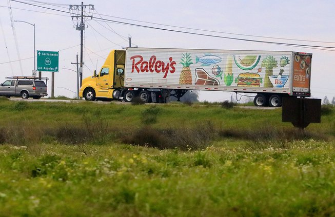
Lathrop’s city leadership is right in that the business park development truck traffic from the likes of 5.11 Tactical, Penske’s/Lowe’s and future envisioned business parks to the north is being pushed down Roth Road to Interstate 5. There is the issue of two truck parking yards — an existing 154-space yard appropriated by Amazon as a staging area for its pumped up Amazon Prime pandemic business to a proposed 400-plus space facility. The problem is most of those truckers renting the spaces will be making intermodal movements or hauling from other distribution centers of which the bulk are in Lathrop and Stockton.
Lathrop is right that is takes a lot of wild assumptions for Manteca leaders to think it is OK to dump truck traffic generated by Manteca growth down Lathrop’s segments of McKinley Avenue.
Complicating things even more is that Airport Way, once it passes French Camp Road, serves a large swath of developable industrial property.
Given that Manteca is moving forward with the McKinkey Avenue interchange, there is a more reasonable solution rooted in being realistic that makes more sense but is not perfect.
Airport Way from Louise Avenue to the 120 Bypass should be a truck route and should not be wider than four lanes.
That means truck traffic from future business parks south of Louise Avenue as well as the existing Medline/Amazon complex could use Airport Way to access the 120 Bypass.
Once the McKinley Avenue interchange opens it will be quicker to use that exist instead of Airport Way to reach the 900-pound gorilla of traffic generation — Costco — that is located roughly midway between McKinley Avenue and Airport Way.
The city’s plan to extend Milo Candini Drive to Yosemite will provide an effective bypass of Airport Way for “in town” residents to reach Costco and nearby destinations.
As for the business park traffic north of Lathrop Road, the odds are most want to reach either Highway 99 or Interstate 5. As such the spine road would do nothing to address the concerns of Del Webb residents of those along Lathrop Road.
Given much of the truck traffic in question is from the intermodal facility, the portion Manteca generates is the issue. How much future business park development impacts Lathrop and what it’s fair share of the costs is stands as a legitimate question to address.
As for truck traffic heading down Airport Way and then east to Highway 99, Manteca needs to employ low-tech research by having humans at the corner of Roth/Airport and at the access points of the three distribution centers facing Airport Way track truck movements 24/7 for two weeks to determine where they originate.
Once that data is in hand they can determine how much of the problem they can actually address. Right now it would appear that the biggest source of frustration for Manteca and Lathrop is the intermodal operation. If that is the case, spending money on a spine road may be a colossal waste of money and end up delivering on almost none of the promise given UP has already secured environmental clearance to triple the number of truck trips.